Fire burning near Lake Berryessa scorches over 70,000 acres, threatens structures


NAPA COUNTY, Calif. (KGO) -- Over 1,000 firefighters are still battling the County Fire near Lake Berryessa, which has grown to 70,000 acres and threatening over 100 structures.
Officials said the fire nearly doubled in size on Monday. People in Napa County are being told to evacuate.
If you take a stroll along Highway 128 in Yolo County you'll encounter smoke. Cal Fire crews are setting fires to stop the fire.
"A backfire puts black between the main fire and the main edge so that when it comes down there is nothing left to burn," said Brian Ward of the Eldorado Hotshots.
He and his squad were waiting between calls, ready to work in as fire crews literally walked backfires along Highway 128 -- their proverbial line in the sand.
On what should be a busy Independence Day, this massive inconvenience is not the kind of fireworks small business owners had in mind.
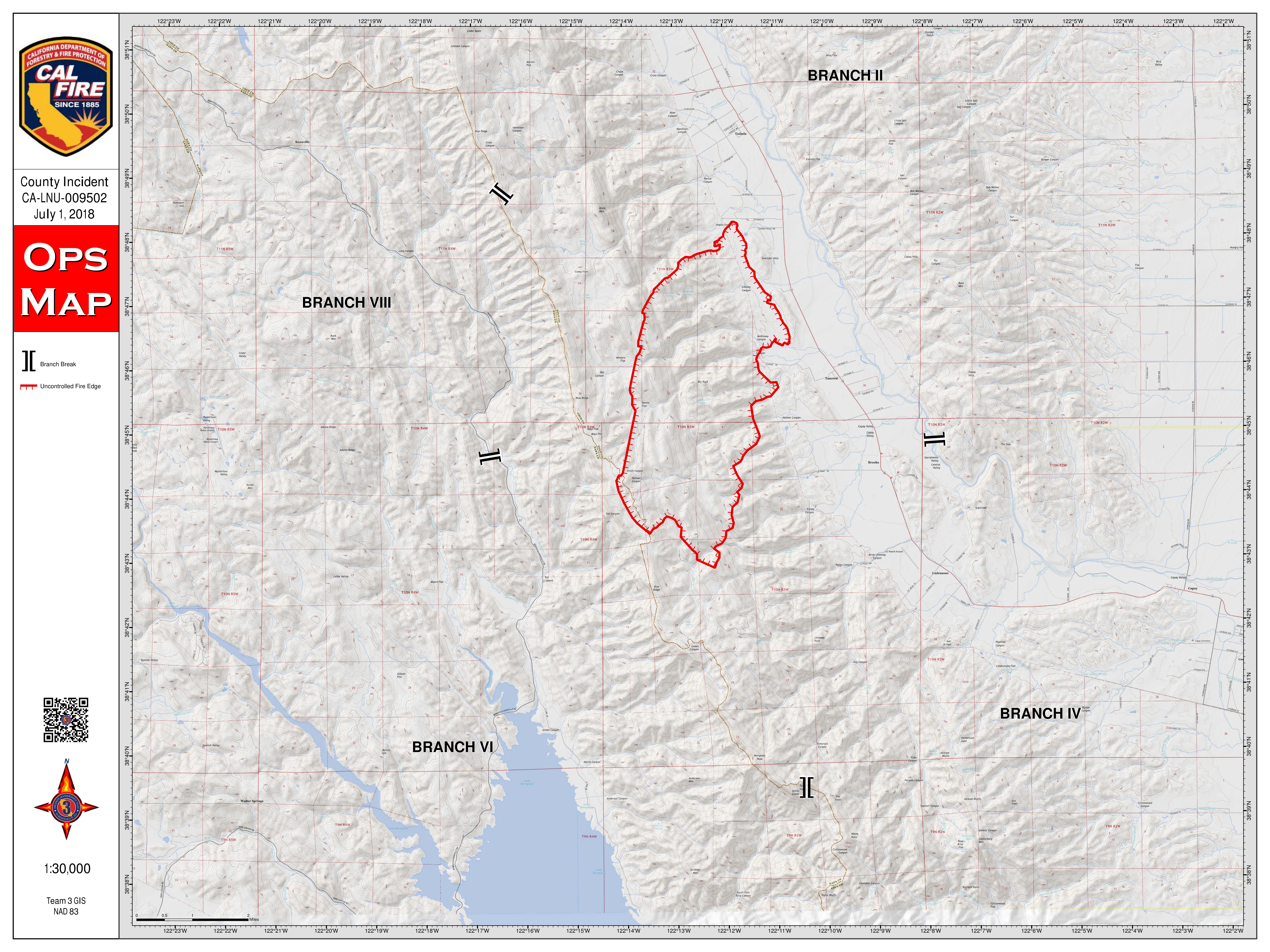
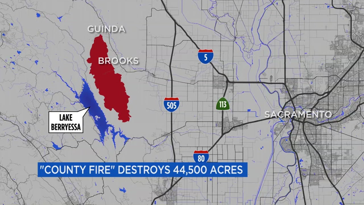
MAP: A look at the 'County Fire' in Yolo County
"We are always optimistic about a good fourth of July," said Chad Frazier of Markey Cove Marina, where the sign on the door says, 'Open' and decorations shout, 'Independence Day.'
But, when the loudest sound is the humming of refrigerators in his store, that's not good.
"Normally over this weekend we would be doing 120 launches a day," said Frazier.
Indeed, as the fire flares, everyone has left, or never showed up, or is leaving.
Jerry Redden may have been the last of them. When the power went out, today, he began packing his motor home. "Yep. I am the last camper," admitted Jerry.
"Any honor in that?" we asked.
"No honor in that," he replied.
In the meantime, firefighters are making progress, it appears, both in the air and on the ground, where dozers and hand crews spent the day on Monday cutting lines, trying to hold the line and take advantage of the relatively benign weather conditions.
Cal Fire officials say their goal is to have full containment of this fire by next Tuesday, July 10, 2018. So far, it is only 5 percent contained.
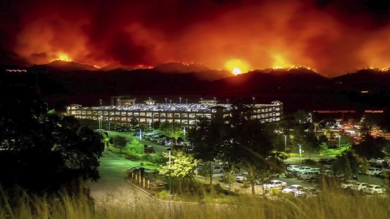
PHOTOS: County Fire burning near Lake Berryessa


EVACUATION ORDERS, ROAD CLOSURES:
Mandatory evacuations:
Residences served by Highway 128, between Monticello Dam and Pleasant Valley Road.
North of Highway 128
South of County Road 23
East of Berryessa Knoxville Road
West of County Road 89, South of the community of Esparto, however agricultural equipment will be permitted
Evacuation Advisory:
North of Quail Canyon Road
South of Highway 128
East of the Blue Ridge mountains
West of Pleasant Valley Road
East of Capell Valley Road
North of State Highway 128 from Capell Valley Road, East to the Napa County line
All of Steele Canyon Road
For questions regarding Yolo County evacuations or advisories, please dial 2-1-1 For questions regarding Solano County evacuations or advisories please dial (707) 398-8261
Evacuation center: Guinda Grange Hall in the Community of Guinda 16487 Forest Ave. Guinda, CA 95637
Road closures:
Northbound County Road 87 from Highway 128, Berryessa Knoxville Road, from the Pope Creek Bridge to the Napa/Lake County line, Eastbound Highway 128 at Markley Resort, Westbound Highway 128 at Pleasant Valley Road, Pleasant Valley Road, South from Highway 128 remains open to serve traffic into Solano County
Cooperating Agencies:
California Department of Corrections and Rehabilitation, Cal OES, California Highway Patrol, California Conservation Corps, Yolo County OES, Yolo County Sheriff, Solano County Sheriff, Napa County Sheriff, PG&E, Bureau of Indian Affairs, Yocha Dehe Wintun Nation, Bureau of Land Management, United States Forest Service, and California National Guard.
The fire sent smoke across the Bay Area, as far west as Petaluma and as far south as San Francisco and Redwood City, according to the National Weather Service in San Francisco.


