AccuWeather Forecast: Chance of patchy drizzle near coast tonight

Takeaway of the Day
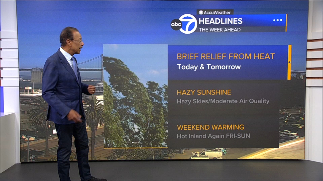
The cooling marine layer returned to the coast and bay overnight, resulting in a noticeable cooldown. Low clouds and fog lingered well into the mid-morning hours, and afternoon highs were generally 5 to 8 degrees lower than yesterday's highs. At 4 p.m., temperatures were mainly in the mid-60s at the coast, mid-to-upper 70s near the bay, and upper 80s to lower 90s inland. The marine layer will deepen and expand locally inland again tonight, along with the chance of patchy drizzle near the coast.
A Look Ahead
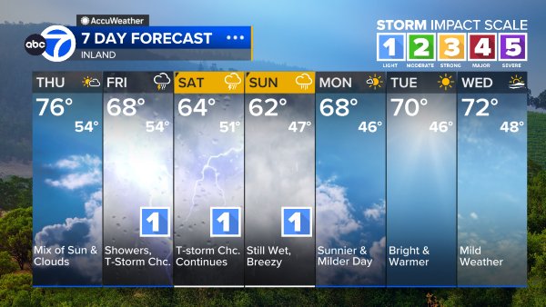
Tomorrow will be much like today as the current cooling trend continues. The marine layer will be slow to retreat to coast, which will inhibit the afternoon warming process. Highs will likely reach mid-to-upper 60s at the coast, lower 80s around the bay, and lower 90s inland. This period of "cooling relief" will be short-lived, however, as another warming trend will develop Friday through Sunday, with high temperatures inland once again in the triple digits. Be prepared for the weekend heat spike.
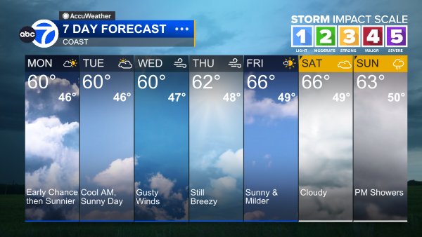
Coast
Bay Shoreline
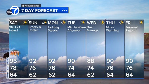
Inland
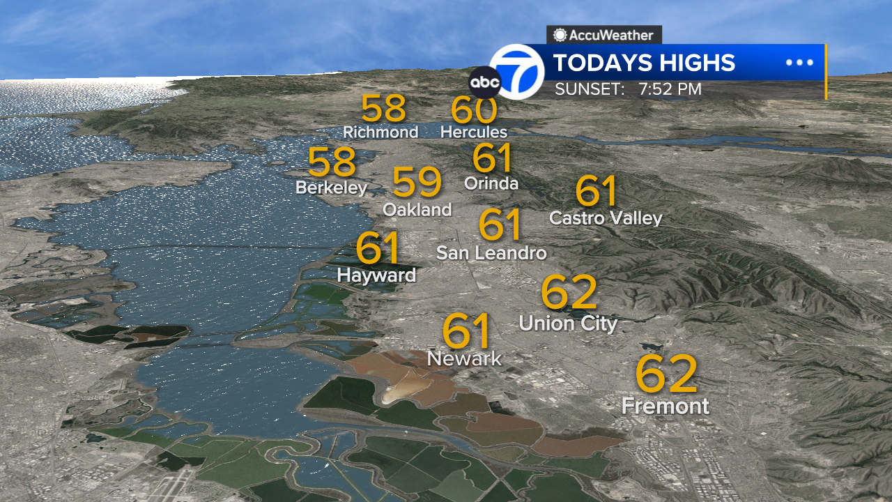
East Bay High Temps
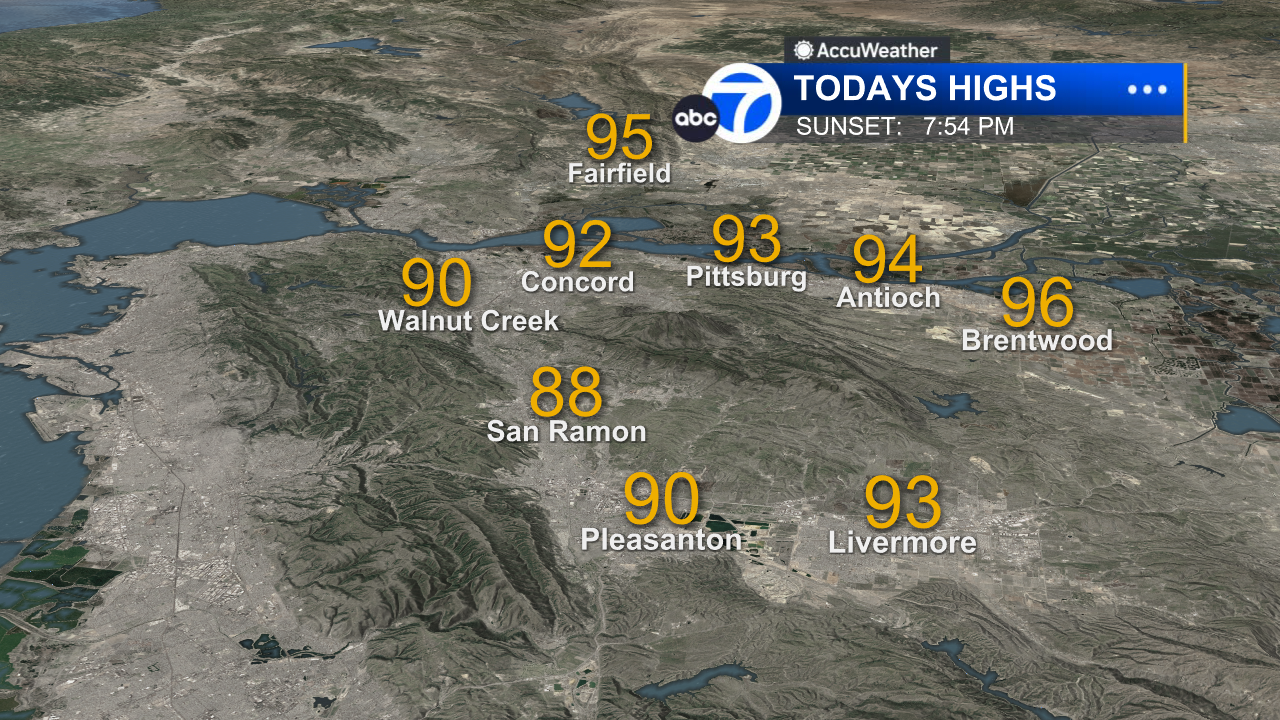
Inland East Bay High Temps
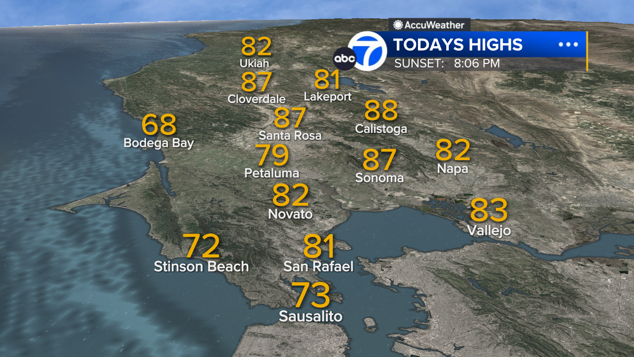
North Bay High Temps
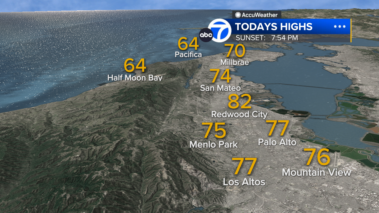
Peninsula High Temps
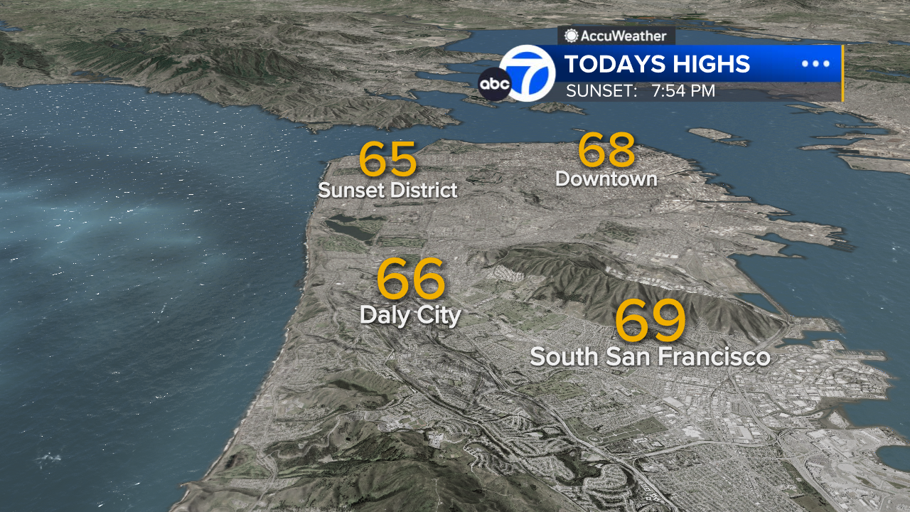
San Francisco High Temps
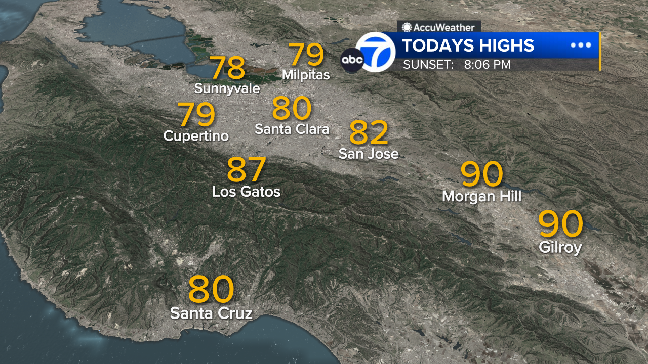
South Bay High Temps
- Download: ABC7 Accuweather app for iPhone and Android
- CA Weather Tracker: Reservoir levels, precipitation trends, snowpack totals
- Weather Radar: LiveDoppler7 radar images
- Weather Alerts: Current Watches and Warnings
- Share: Tag weather photos #ABC7Now
SHARE YOUR PHOTOS: We love seeing photos and videos from where you live! Share yours by posting with #abc7now. You must have taken the image/video or otherwise own all rights to it and agree that KGO-TV and its licensees can use, edit and distribute it without restriction in all media. Full terms: abc7news.com/share