
CAL FIRE's new map shows detailed info about Pickett Fire
New to CAL FIRE's resources this year are maps that show you up-to-date data about wildfires across the state.
You can track where aircraft are, what zones have been evacuated and much more.

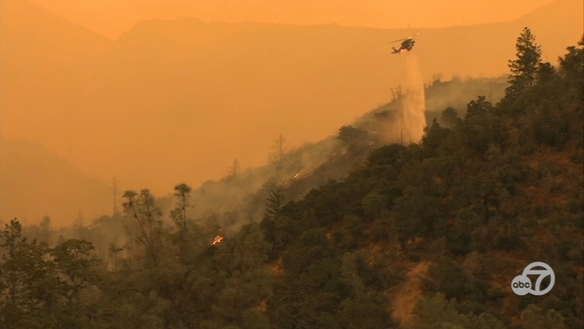
CALISTOGA, Calif. (KGO) -- The Pickett Fire, which burned for more than two weeks in Napa County, is fully contained, CAL FIRE announced on Sunday. It burned 6,819 acres.
Evacuations were ordered back on August 21 for some residents near Calistoga in Napa County for the then-growing brush fire.
All evacuations and warnings were lifted on September 2.
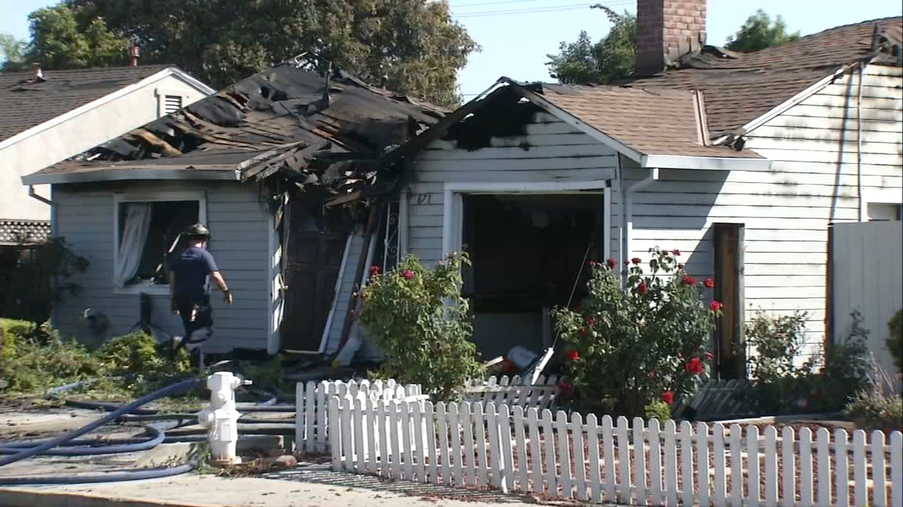
At last check, the fire damaged at least five buildings and no injuries were reported.
The fire threatened and impacted rural areas of Napa County, including the unincorporated parts of Calistoga, Pope Valley, Aetna Springs, and Angwin, officials said.
Ground crews were aided by an air tanker and a helicopter dropping water on the flames.
ABC7 News meteorologist Drew Tuma says the fire burned in the same area as the Glass Fire in 2020.
The cause of the fire is still under investigation, though previous reports say it was either connected to a winery or a control burn.
MAP: Track wildfires across California

New to CAL FIRE's resources this year are maps that show you up-to-date data about wildfires across the state.
You can track where aircraft are, what zones have been evacuated and much more.

CAL FIRE says the Pickett Fire burning east of Calistoga is now 5% contained.
The fire has scorched more than 2,000 acres since it broke out Thursday afternoon.


Firefighters are dealing with several tough conditions as they fight the Pickett Fire near Calistoga.
It is extremely smoky, and Cal Fire says the terrain is difficult.
This morning, officials said that they are having issues even accessing parts of the fire.
In addition to the ground tools, they've been using air tankers, helicopters and even night vision goggles so that they can continue fighting the fire at night.
Add the hot weather to the tough terrain and it makes for one of the most challenging firefights these crews have faced.
"We are really focusing with our safety officers and our and our line medics to evaluate all personnel on the fire and truly reiterating that work rest cycle with our firefighters and providing them additional resources to support them throughout the day and throughout the incident," Cal Fire Unit Chief Matt Ryan said.
Cal Fire planned to send an intel flight up to be able to get an update on progress, like containment of the fire and the acres burned.
They said this morning that there were three structures that were threatened, but there have been no reports of injuries and no reports of damaged structures.

A new evacuation order has been issued for the Pickett Fire burning just east of the town of Calistoga.
The zone is NPA E115, which runs North and South of Aetna Springs, East of Victoria Drive and Oat Hill, West of Summit Lake Dr.
There are also additional evacuation warnings for zones NPA E107 and POPE001B (South of James Creek Rd).