AccuWeather Forecast: Cooling trend arrives; gusty winds, low humidity heightens fire risk

Takeaway of the Day
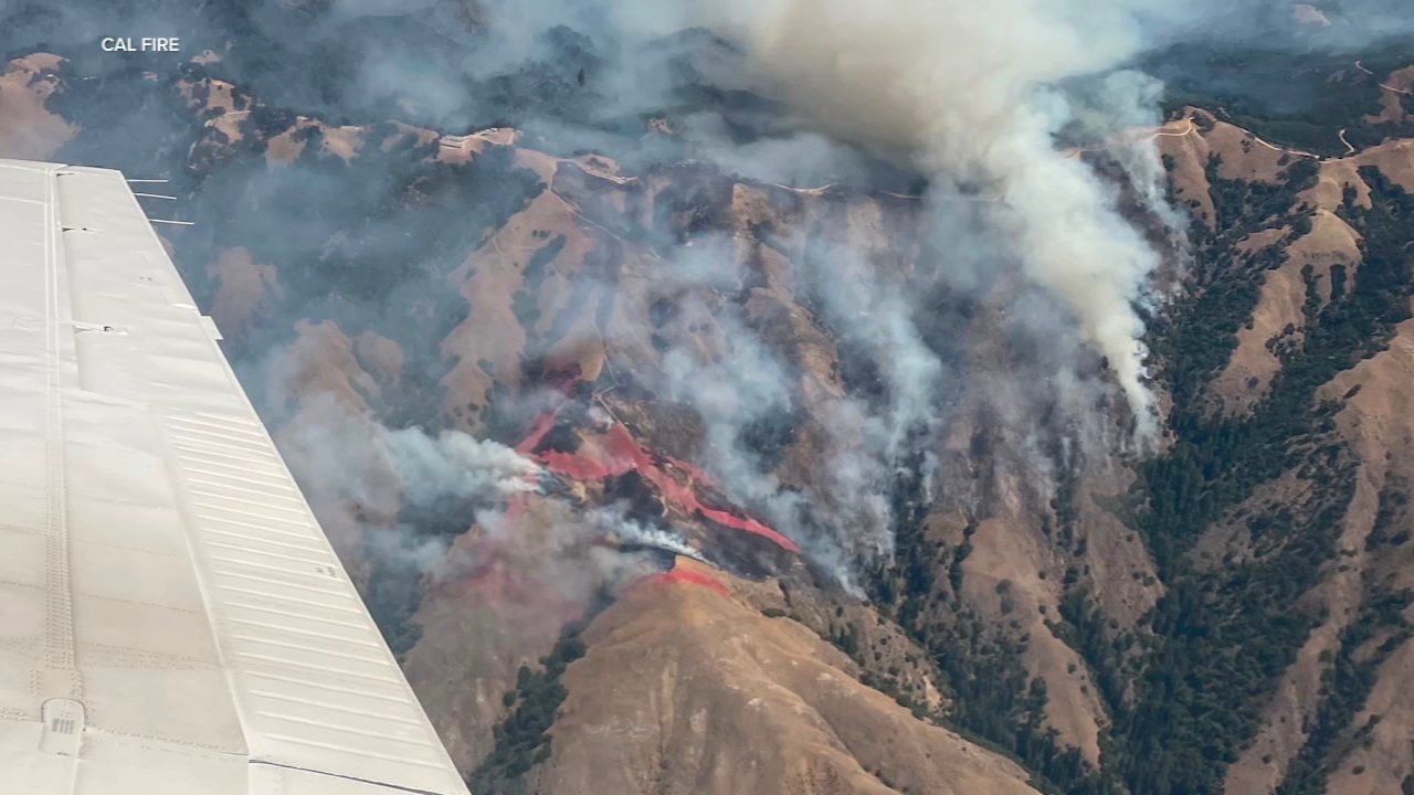
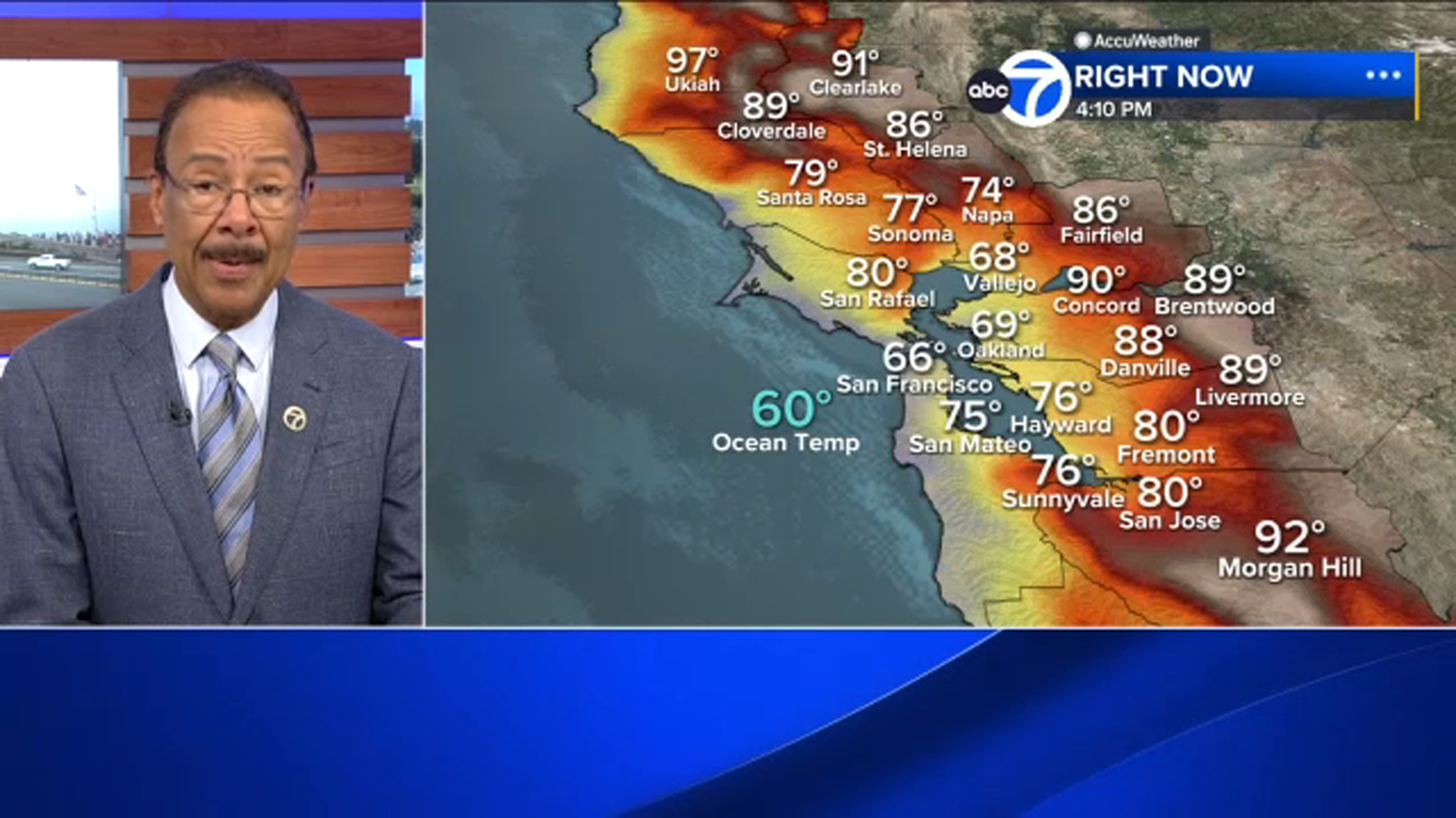
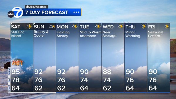
Relief from the weekend heat has arrived. A deeper marine layer and onshore winds combined today to end the threeday heat spike. Midafternoon temperatures ranged from the mid60s at the coast to the mid70s near the bay and the mid to upper80s inland - about 6 to 10 degrees lower than yesterday's highs. Despite the cooler air, fire danger remains elevated in the Bay Area's higher terrain because of low humidity and gusty winds moving through passes and over ridges.
A Look Ahead
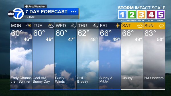
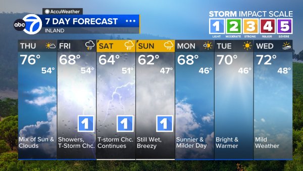
The next few days will bring additional cooling, with high temperatures dropping a few degrees below midAugust averages by midweek. Increasing clouds are expected later this week, especially near the coast and bay, along with a very slight chance of light rain or showers in higher terrain. No significant warming is likely before the middle of next week. A coastal flood advisory remains in effect until 2 a.m. Thursday, and high tides may cause minor flooding in lowlying areas along the bay shoreline and the coast.
Coast
Bay Shoreline
Inland
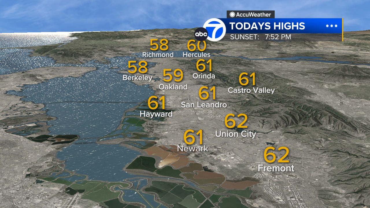
East Bay High Temps
Inland East Bay High Temps
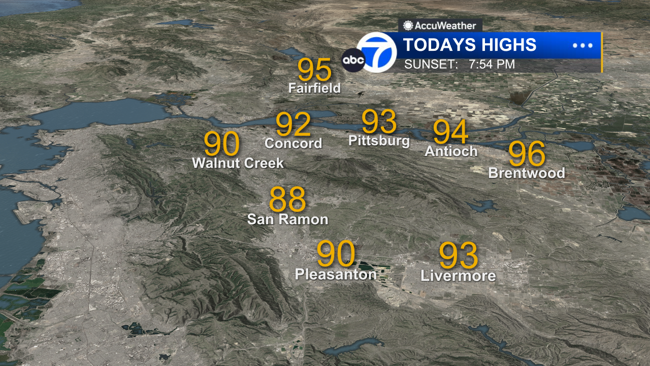
North Bay High Temps
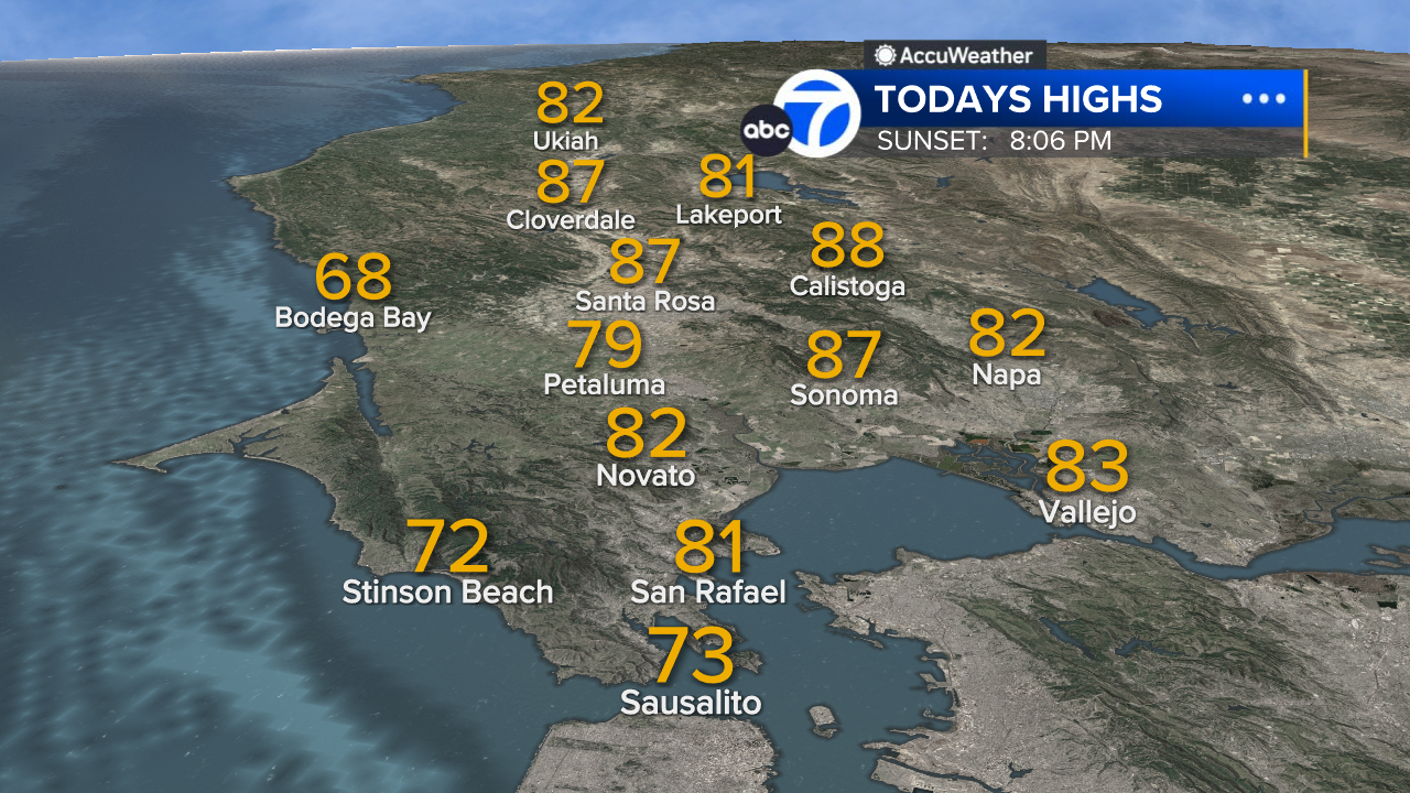
Peninsula High Temps
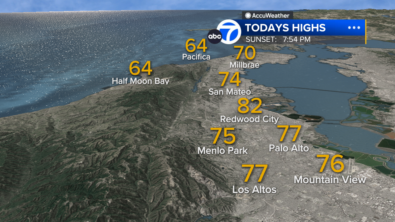
San Francisco High Temps
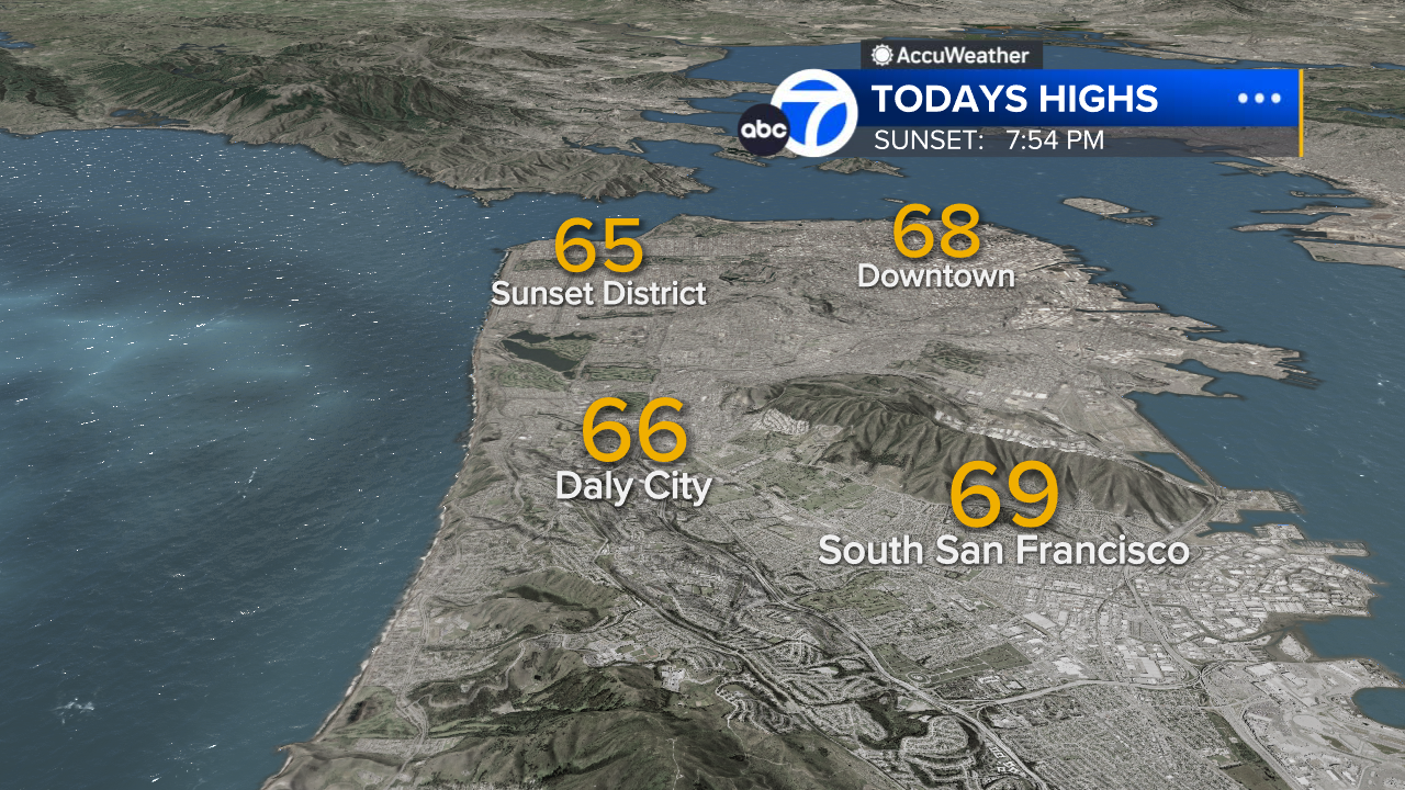
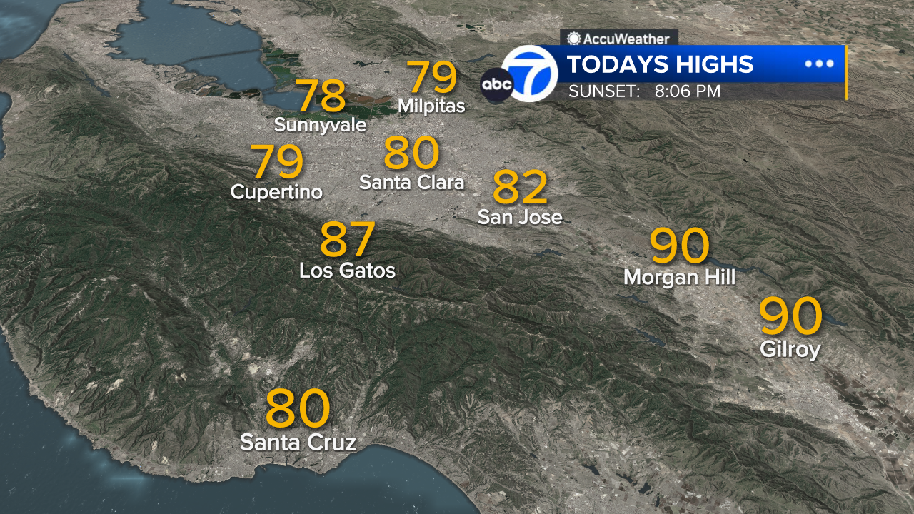
South Bay High Temps
- Download: ABC7 Accuweather app for iPhone and Android
- CA Weather Tracker: Reservoir levels, precipitation trends, snowpack totals
- Weather Radar: LiveDoppler7 radar images
- Weather Alerts: Current Watches and Warnings
- Share: Tag weather photos #ABC7Now
SHARE YOUR PHOTOS: We love seeing photos and videos from where you live! Share yours by posting with #abc7now. You must have taken the image/video or otherwise own all rights to it and agree that KGO-TV and its licensees can use, edit and distribute it without restriction in all media. Full terms: abc7news.com/share