County Fire burning near Lake Berryessa scorches 86,000 acres


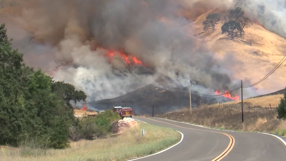
NAPA COUNTY, Calif. (KGO) -- The County Fire burning near Lake Berryessa has grown to 86,000 acres in the rough, mountainous terrain of Yolo and Lake counties and is threatening nearly 1,000 structures. So far, the fire is 30 percent contained.
The Yolo County Sheriff just ordered additional mandatory evacuations and road closures. The evacuation order applies to the area west of State Highway 16 to the Yolo-Lake County line, north of County Road 40 and south of the Yolo County line. State Highway 16 has been closed between State Highway 20 and Rumsey Hall.
MAPS: A look at the 'County Fire' in Yolo County
Over 2,800 firefighters are still battling the blaze that nearly doubled in size on Monday.
"The fire laid down, last night," said Cal Fire spokesman Israel Pinzon. Crews worked all night building containment lines along the fire.
At least 2,500 people have been told to evacuate as the so-called County Fire continues to spread, said Anthony Brown, a spokesman with the California Department of Forestry and Fire Protection.
PHOTOS: County Fire burning near Lake Berryessa


Brown said the blaze started Saturday and is surging through rugged terrain northwest of Sacramento amid hot and dry weather. "The weather is better than what we had last weekend. But it's still hampering our efforts and it's an area of concern," he said.
So far this year, wildfires have burned 4,200 square miles in the United States, according to the fire center. That's a bit below last year's acreage to date - which included the beginning of California's devastating fire season - but above the 10-year average of 3,600 square miles.
Cal Fire officials say their goal is to have full containment of this fire by next Tuesday, July 10, 2018.
EVACUATION ORDERS, ROAD CLOSURES:
Mandatory evacuations:
Area west of State Highway 16 to the Yolo-Lake County line, north of County Road 40 and south of the Yolo County line.
Residences served by Highway 128, between Monticello Dam and Pleasant Valley Road.
West of State Highway 16, to Berryessa Knoxville Road, South of Old County Road 40, and North of County Road 53
Evacuation Advisory:
North of Quail Canyon Road
South of Highway 128
East of the Blue Ridge mountains
West of Pleasant Valley Road
East of Capell Valley Road
North of State Highway 128 from Capell Valley Road, East to the Napa County line
Road closures:
State Highway 16 has been closed between State Highway 20 and Rumsey Hall.
Northbound County Road 87 from Highway 128, Berryessa Knoxville Road, from the Pope Creek Bridge to the Napa/Lake County line, Eastbound Highway 128 at Markley Resort, Westbound Highway 128 at Pleasant Valley Road, Pleasant Valley Road, South from Highway 128 remains open to serve traffic into Solano County
Cooperating Agencies:
California Department of Corrections and Rehabilitation, Cal OES, California Highway Patrol, California Conservation Corps, Yolo County OES, Yolo County Sheriff, Solano County Sheriff, Napa County Sheriff, PG&E, Bureau of Indian Affairs, Yocha Dehe Wintun Nation, Bureau of Land Management, United States Forest Service, and California National Guard.
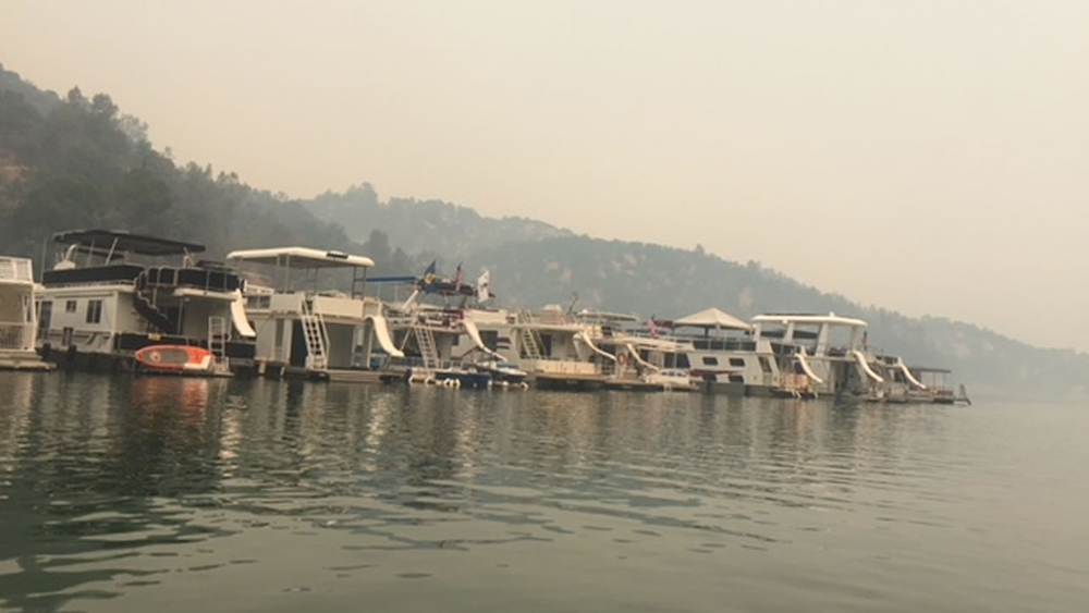
The fire sent smoke across the Bay Area, as far west as Petaluma and as far south as San Francisco and Redwood City, according to the National Weather Service in San Francisco.
CAL FIRE map of the "County Fire"
The Associated Press contributed to this story.