Flooding hits San Francisco's Embarcadero as experts warn of more to come


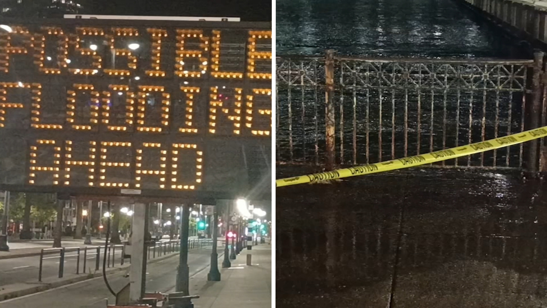
SAN FRANCISCO (KGO) -- Overnight flooding along San Francisco's Embarcadero is offering a preview of what scientists warn could become more frequent as sea levels rise.
Michael Beck, director of the Center for Coastal Climate Resilience at UC Santa Cruz, said conditions are expected to worsen and require long-term planning and investment.
"It is going to get worse, and we need to start preparing for the fact that it is going to get worse. There are some places which we are going to have to invest in more protection. There are some places where we can still rely on wetlands, and wetlands coupled with our levies, to reduce some of these risks in the future," Beck said.
MORE: Parts of San Francisco are sinking at a rapid pace, NASA data shows
Beck said the weekend flooding event was driven by several factors, including El Niño conditions and unusually warm Pacific waters.
"Our waters off the Pacific are warmer than usual, and this is likely to drive some very significant storms even throughout the winter. So, what I would say right now is, this gives us a bit of a prelude to what we could be seeing even more of with higher levels during the winter, if these high tides are coupled with some storms that could be stronger and more frequent than normal," he said.
City officials emphasize that preparedness is critical, particularly in low-lying areas such as San Francisco International Airport and the Embarcadero, which are vulnerable to rising sea levels.
San Francisco Supervisor Danny Sauter said long-term efforts are already underway to strengthen coastal defenses.
MORE: Experts examine how climate change will create more king tides in Bay Area
"Long term, we need to build up our seawall. The voters in 2018 approved a bond to start that work. This is work that's going to take decades. It's going to take billions of dollars. The voter approved bond was $425 million. So, it gets us started," Sauter said.
The San Francisco Bay Conservation and Development Commission, along with the Metropolitan Transportation Commission, has studied proposed and potential projects across the Bay Area. They are pushing for regional solutions.
"BCDC and the Metropolitan Transportation Commission did a study about 3 years ago, and we looked at all the proposed projects and then we looked at places without proposed projects and figured what would actually fit there. And we used that modeling to come up with $96 billion," said Larry Goldzband of the commission.
The risk of flooding along the Embarcadero is expected to continue through Wednesday.