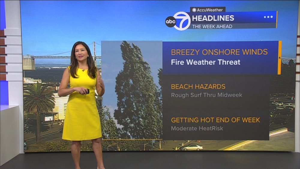
Very strong El Nino has formed. Here's how it will impact Bay Area and beyond

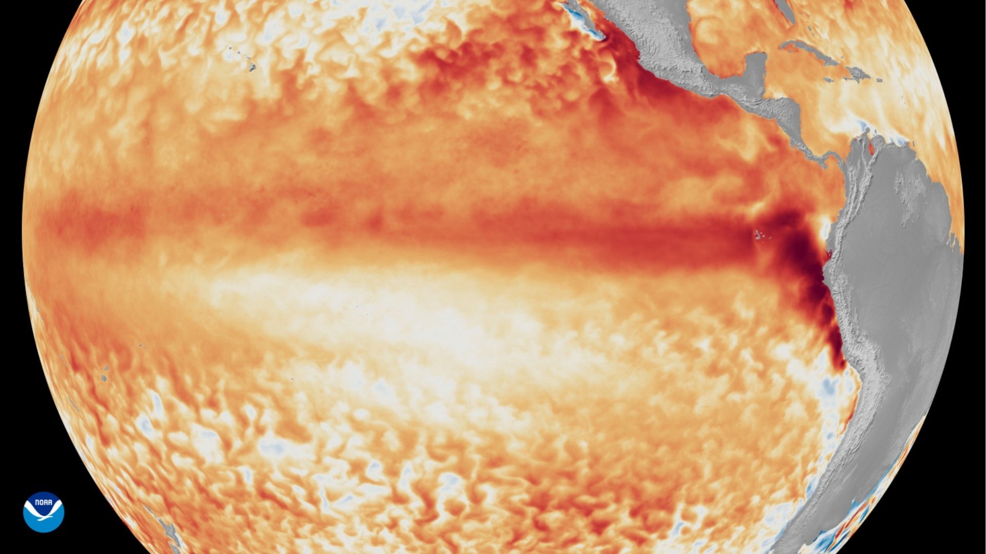
SAN FRANCISCO -- The National Oceanic and Atmospheric Administration announced that El Nino conditions have developed in the tropical Pacific. This declaration is made when ocean water temperatures are at least 0.5 degrees Celsius above average for several months.
According to ABC7 Meteorologist Drew Tuma, the forecast calls for these conditions to strengthen over the next several months, leading to water temperatures more than 2 degrees Celsius above average, leading to a very strong El Nino event.
Drew says when El Nino conditions prevail, the storm track across the United States usually hovers over southern California in the winter. This tends to lead to higher-than-average rainfall across California during the winter months.
Every El Nino event is different and will require monitoring throughout the winter as storms develop in the Pacific.
Typical El Nino impacts across the United States
Impacts from El Nino, similar to La Nina, tend to be most consistent and pronounced from late autumn through early spring following the event's onset, NOAA says. There is usually a delay between the onset of the event and many of the associated effects.
Experts caution that the impacts on weather patterns are nuanced. Each season is different, and typical El Nino conditions don't always materialize.
"Every El Nino is different in terms of timing, magnitude, and geographic extent, and such differences lead to variability in the impacts -- on temperatures and rainfall, for example -- on a global scale," Andrew Kruczkiewicz, senior staff researcher at Columbia Climate School, said.
Typically, during El Nino, the northern half of the United States and parts of Alaska are more likely to see warmer-than-average temperatures, with near- to below-average temperatures favored along the southern tier of the U.S., most likely from Texas to the Southeast.
For precipitation, wetter-than-average conditions are typically observed along the southern tier of the U.S. in parts of California, the Southwest, Gulf Coast and Southeast. Below-average precipitation is frequently observed across parts of the northern Rockies, south-central Mississippi Valley, Ohio Valley and Great Lakes regions.
El Nino typically increases the odds of above-average snowfall in the southern Rockies, south-central Plains, mid-Atlantic and coastal areas of the Northeast, with below-average snowfall favored in the northern Rockies, northern Plains and Great Lakes regions.
How global warming impacts El Nino, La Nina events
El Nino and La Nina events occur at irregular intervals, typically every 2 to 7 years. El Nino has been somewhat more frequent than La Nina in past observations, but both phases vary in timing and intensity from one cycle to the next.
As Earth's climate warms, however, identifying and measuring these events becomes more challenging because temperature differences are superimposed on the long-term ocean warming trend.
"As the climate warms, interpreting anomalies becomes more challenging," said Dr. Tim Stockdale, principal scientist at the European Centre for Medium-Range Weather Forecasts (ECMWF). "Rising background temperatures can make recent El Nino events appear stronger than they are, and La Nina events seem weaker."
To address these challenges, NOAA and ECMWF updated the way they measure El Nino and La Nina this year, using a new index which compares sea surface temperatures in the central Pacific to global tropical ocean conditions rather than just that region's historical data. NOAA calls this new method the Relative Oceanic Nino Index (RONI), which helps remove the effect of overall ocean warming.
The WMO notes that there is no evidence that human-amplified climate change increases the frequency or intensity of El Nino events.
El Nino's influence on hurricane season activity
El Nino conditions often suppress tropical activity during the Atlantic hurricane season by producing unfavorable atmospheric winds. In the Eastern Pacific, the opposite occurs, with favorable conditions supporting above-average hurricane season activity.
"El Nino increases convection (thunderstorms) across the eastern and central Pacific, which causes downstream wind shear over the Atlantic from strong upper-level winds," said Andy Hazelton, an associate scientist at the University of Miami's Cooperative Institute for Marine and Atmospheric Studies.
Vertical wind shear, which refers to changes in wind speed and direction with height in the atmosphere, is often a primary factor in below-average hurricane season activity. Strong vertical wind shear can tear a developing tropical system apart or even prevent it from forming, NOAA says.
"The rising motion over the Pacific also leads to increased subsidence (sinking air) over the Atlantic, which suppresses thunderstorms and tropical cyclone development," Hazelton added.
El Nino's impact on tropical activity will largely depend on how quickly it intensifies. Even so, El Nino is only one of several important variables which influence tropical activity.
Other factors, such as sea surface temperatures, also play an important role in tropical cyclone development and strength. Unseasonably warm ocean waters can partially offset the effects of unfavorable atmospheric winds, according to forecasters.
Global temperature records could be challenged again
2024 ranked as the planet's warmest year on record, following the last El Nino event, which emerged in mid-2023 and persisted through spring 2024, according to NOAA. However, the return of El Nino means global temperature records could be challenged again in the near future, depending on its peak intensity and duration.
While global air and sea surface temperatures are currently falling short of new record highs, climate scientists warn this pause is unlikely to last. Record highs in global average temperature often occur during El Nino years, combined with the long-term global warming trend driven primarily by human-caused greenhouse gas emissions.
"Warmer ocean temperatures associated with El Nino, together with its tendency to favor warmer conditions in many areas, often contribute to warmer than normal global annual temperatures," Jon Gottschalck, Chief of the Operational Prediction Branch at NOAA's Climate Prediction Center said.
According to NOAA, 2025 ranked as the third-warmest year on record globally, trailing 2024 and 2023. The slightly lower ranking came amid recent La Niña conditions, which typically cause a temporary dip in global average temperatures.
There is usually a delay between the onset of El Nino and its peak impacts on global temperatures, NOAA says. As with the most recent event, its greatest influence often occurs in the months after it peaks, which can keep global temperatures elevated into the following year.
According to the latest outlook from NOAA's National Centers for Environmental Information, the likelihood that 2026 will rank among the five warmest years on record is about 98.5%, while the probability of it becoming the warmest year is less than 1%. However, those odds could rise significantly in 2027, depending on how the event unfolds.