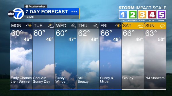
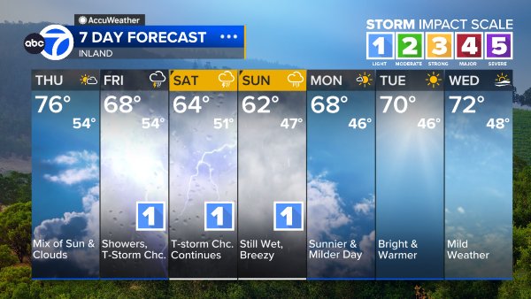
AccuWeather Forecast: Slightly warmer temps tomorrow and Saturday


Takeaway of the Day
A cool day will turn into an even cooler night with lows in the 50s across the Bay Area. Cloud cover returns to coastal communities tonight and winds become calm later this evening.
A Look Ahead
A slight warmup is in store for the Bay Area tomorrow after below-average temperatures started off the month. These warmer temperatures won't last long, cooling down for the 4th of July.
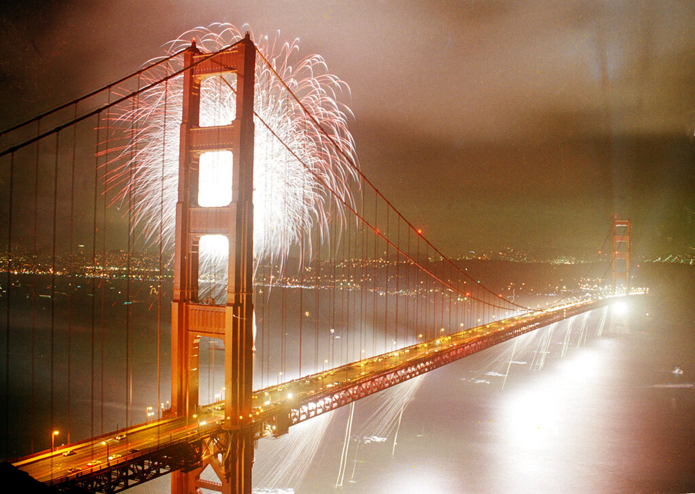
Weather during the day on the 4th will be mild and partly cloudy with temperatures in the 60s at the coast and 70s to 80s farther inland. The fireworks forecast at the coast is looking foggy. After the sun sets around 8:30 p.m. fog and cloud cover quickly move into the area for the overnight hours.
Coast
Bay Shoreline

Inland
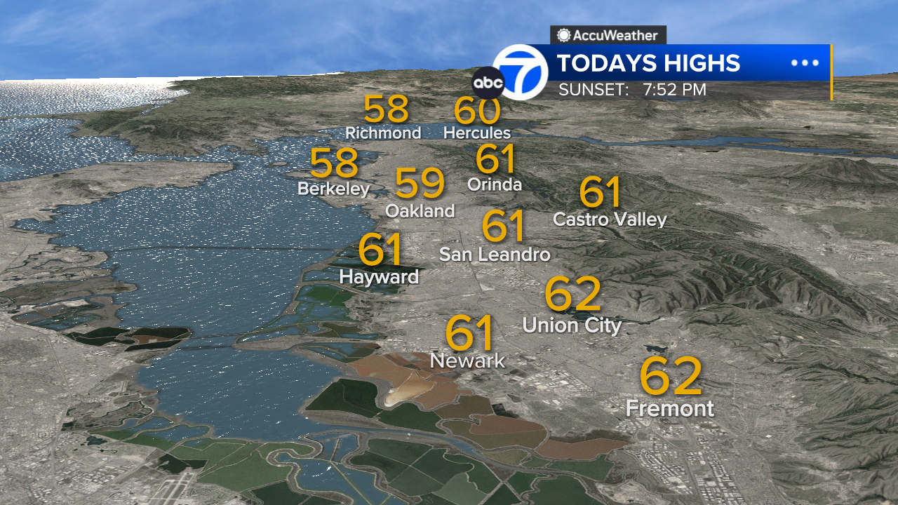
East Bay High Temps
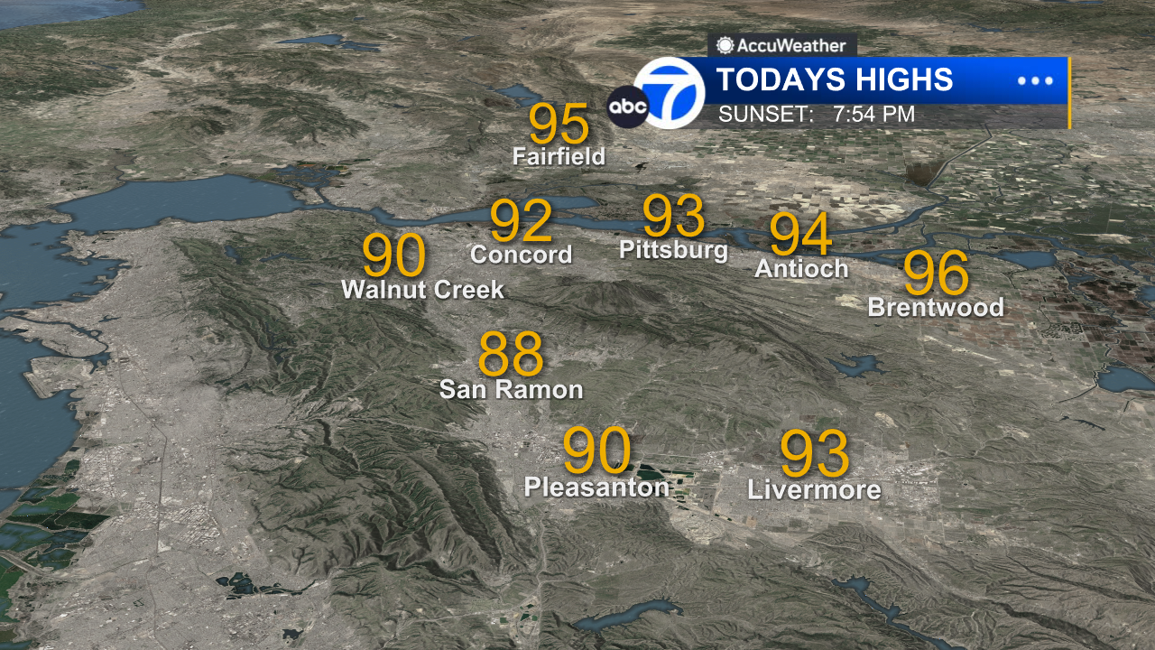
Inland East Bay High Temps
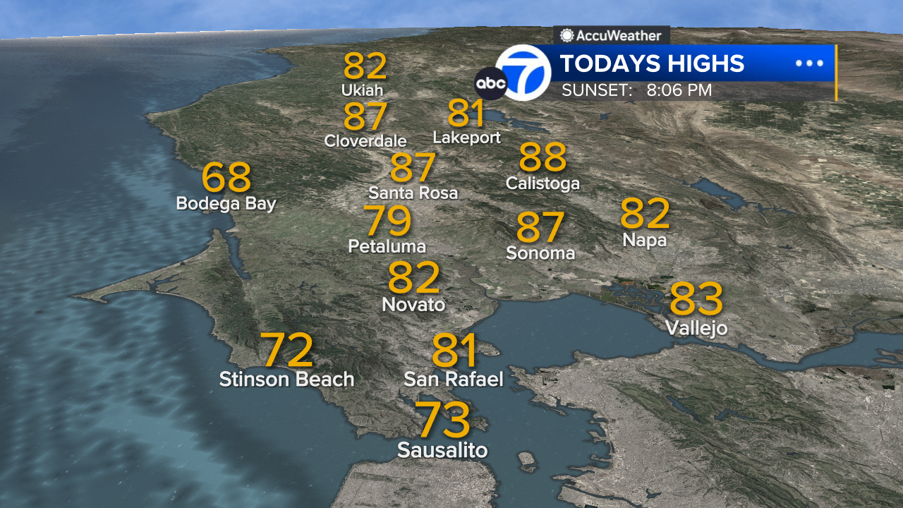
North Bay High Temps
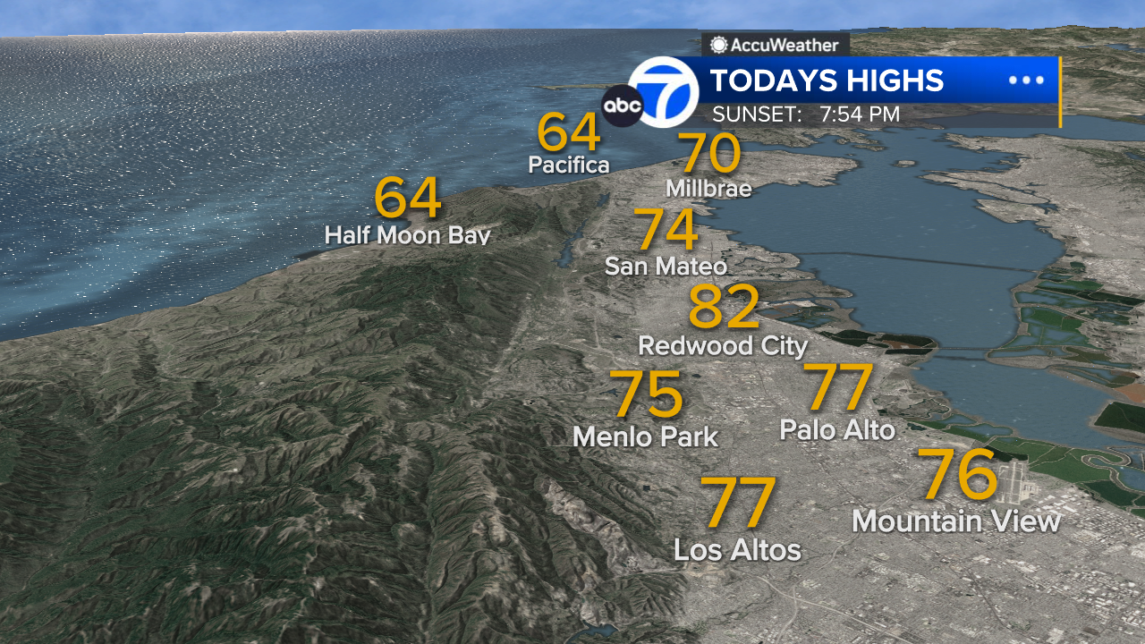
Peninsula High Temps
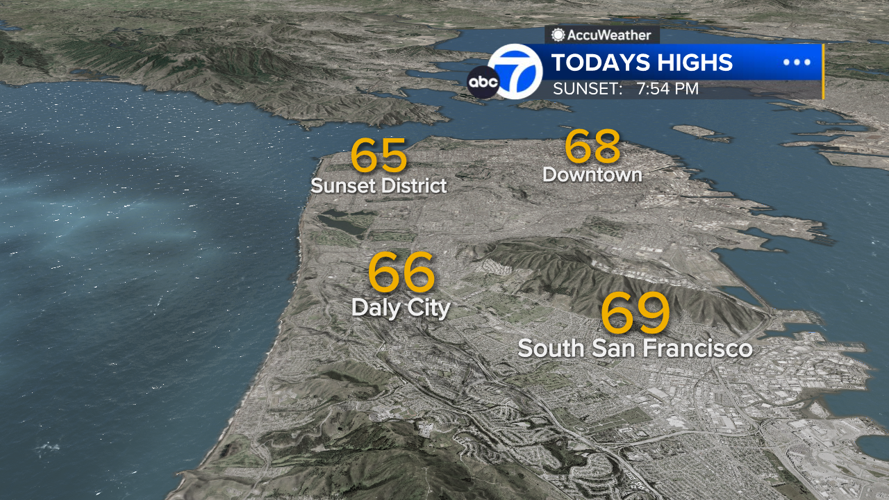
San Francisco High Temps
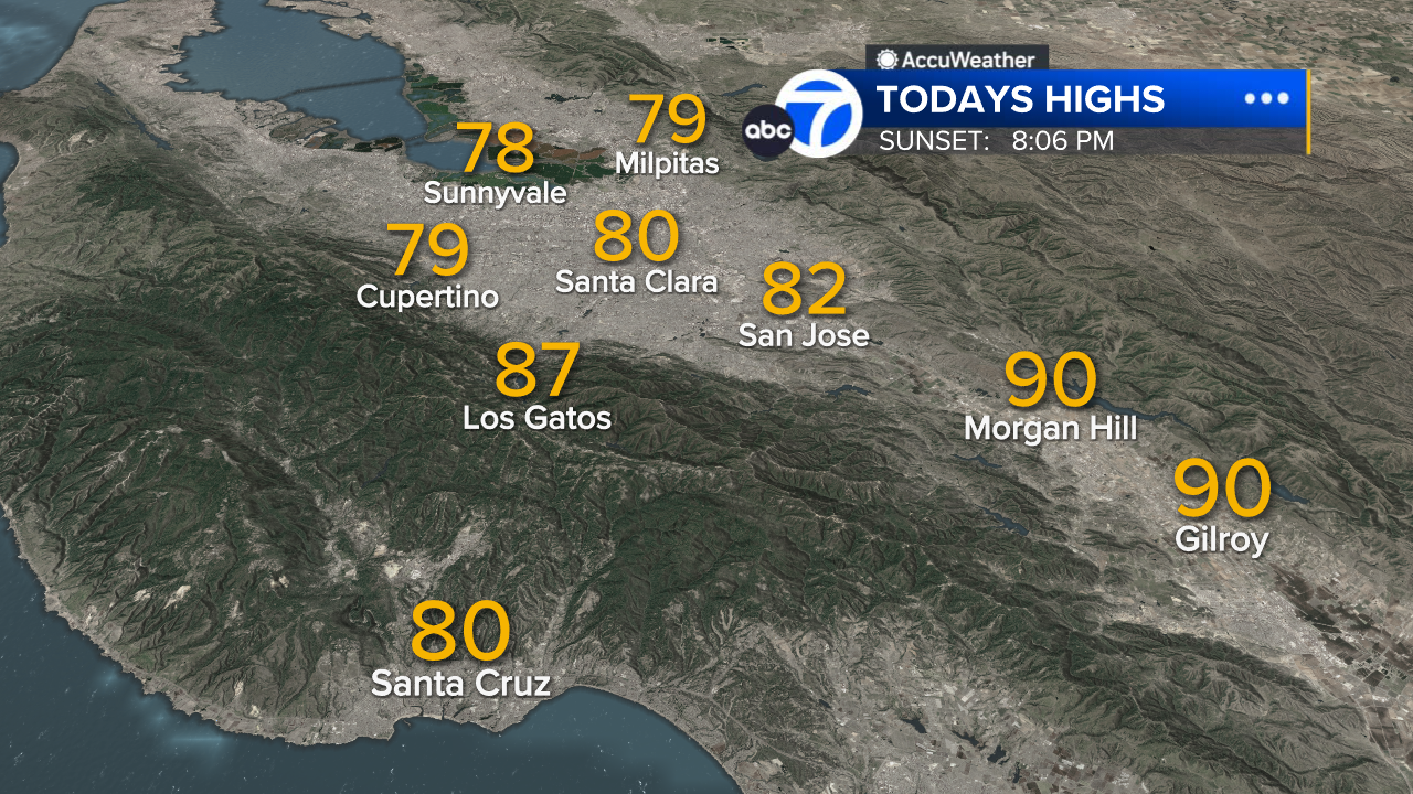
South Bay High Temps
- Download: ABC7 Accuweather app for iPhone and Android
- CA Weather Tracker: Reservoir levels, precipitation trends, snowpack totals
- Weather Radar: LiveDoppler7 radar images
- Weather Alerts: Current Watches and Warnings
- Share: Tag weather photos #ABC7Now
SHARE YOUR PHOTOS: We love seeing photos and videos from where you live! Share yours by posting with #abc7now. You must have taken the image/video or otherwise own all rights to it and agree that KGO-TV and its licensees can use, edit and distribute it without restriction in all media. Full terms: abc7news.com/share