AccuWeather Forecast: Patchy fog tonight mainly along Peninsula, mild and partly cloudy on Tuesday
Takeaway of the Day
Skies are clear to start the evening with slowly falling temperatures.
Patchy fog will eventually fill back in later tonight, mainly along the Peninsula.
Lows will be in the 50s for the most part with a few mid to upper 40s in the inland valleys.
The Look Ahead
Clear and cool conditions will give way to another sunny and mild day on Tuesday.
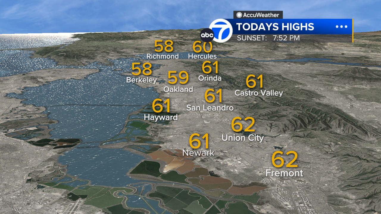
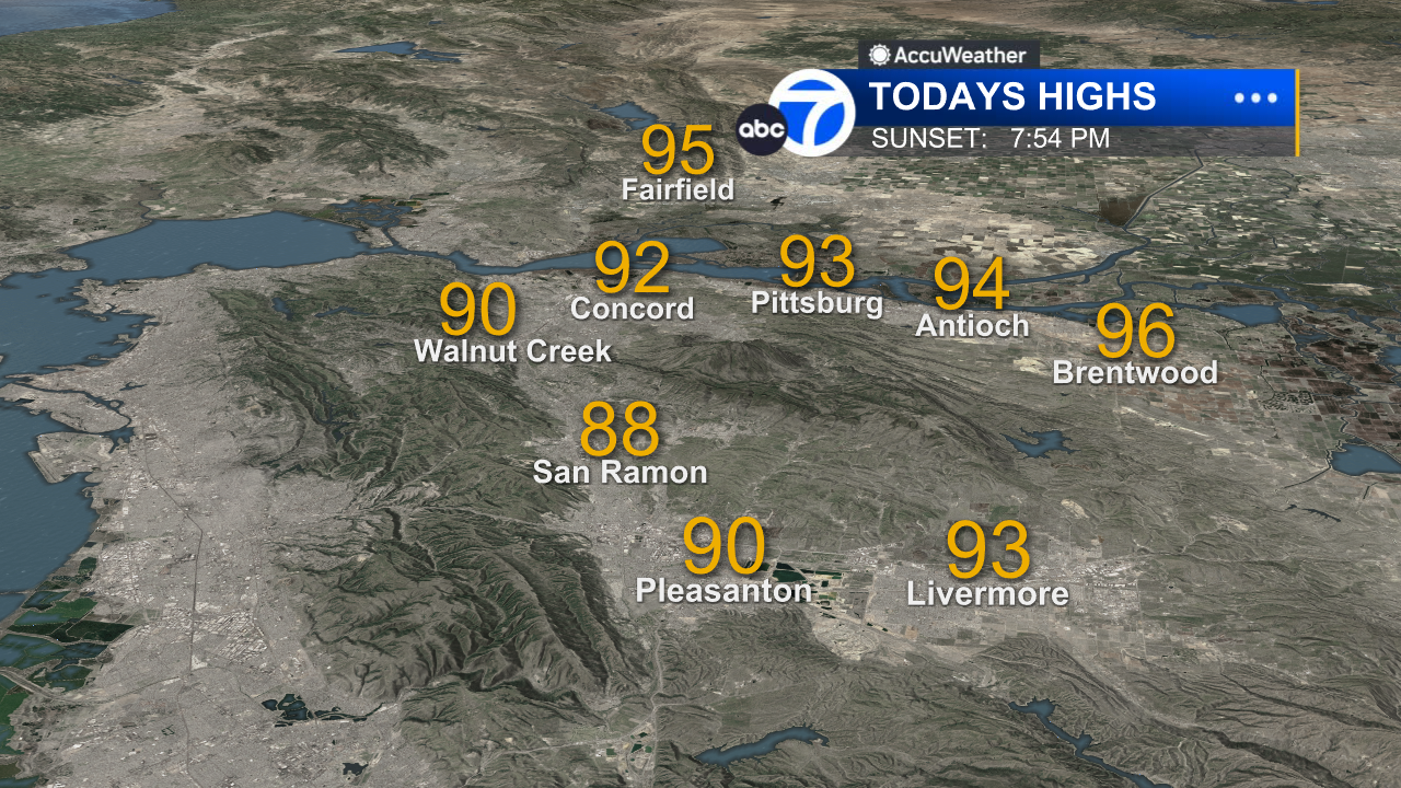
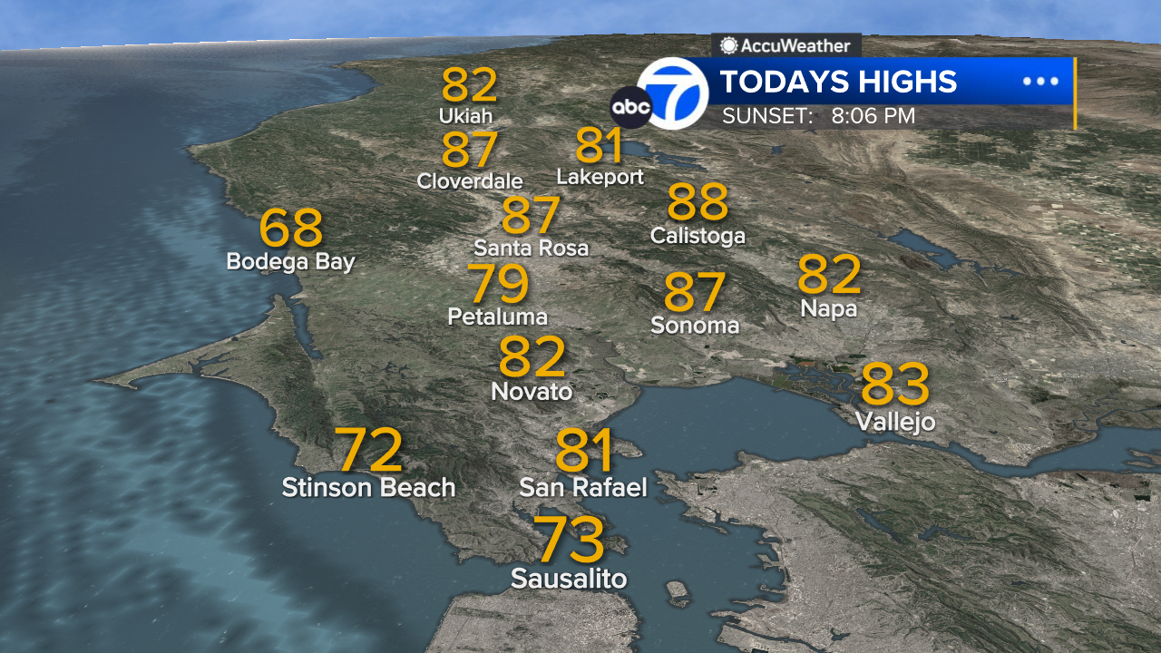
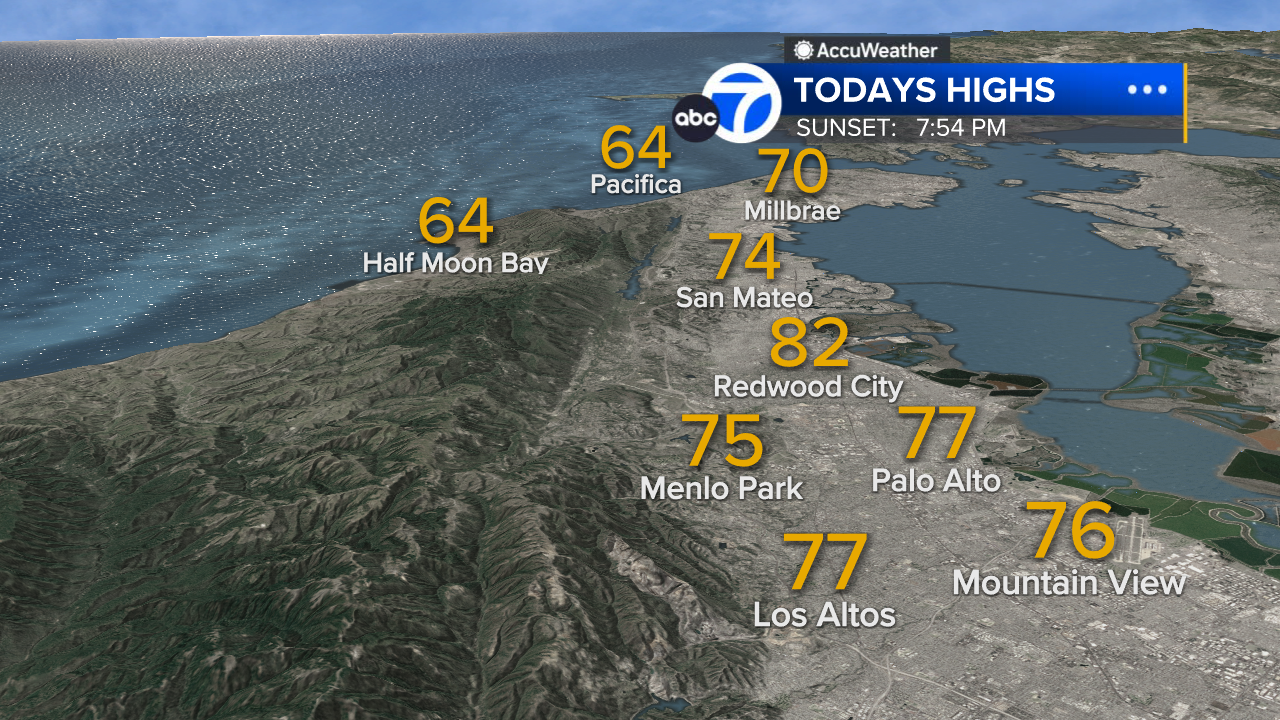
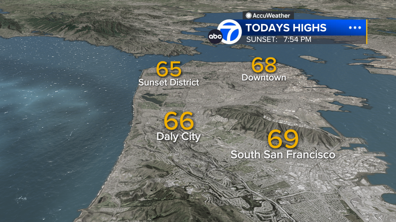
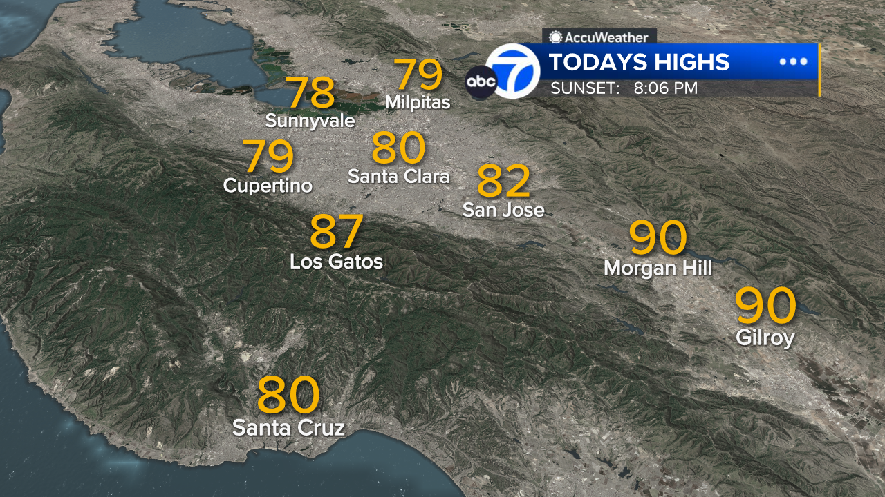
A sea breeze will keep the beaches cool near 60 with patchy fog. Highs near 70 for the bay shore with one more warm day far inland, near 80
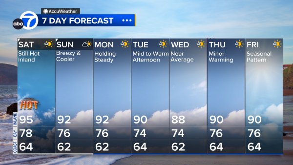
Wednesday will be much cooler, setting the stage for cooler and breezier days through Friday.
The end of the work week will feature highs 5-10 degrees below average.
The weekend will bring a slow warming trend.
7 Day Forecast
- Download: ABC7 Accuweather app for iPhone and Android
- CA Weather Tracker: Reservoir levels, precipitation trends, snowpack totals
- Weather Radar: LiveDoppler7 radar images
- Weather Alerts: Current Watches and Warnings
- Share: Tag weather photos #ABC7Now
SHARE YOUR PHOTOS: We love seeing photos and videos from where you live! Share yours by posting with #abc7now. You must have taken the image/video or otherwise own all rights to it and agree that KGO-TV and its licensees can use, edit and distribute it without restriction in all media. Full terms: abc7news.com/share


