

AccuWeather Forecast: Brace for cold temps as Frost Advisory and Freeze Warning go into effect


Takeaway of the Day
This day before New Year's Eve brought us sunny skies, but a chilly range of temperatures. As of 4:00 p.m., most Bay Area locations are reporting temperatures in the mid to upper 50s with only two locations--San Jose and Concord--at 60 degrees. As we head into the evening hours, we can expect a sharp drop in temperatures, and both a FROST ADVISORY and FREEZE WARNING will be in effect from 8 p.m. tonight until 10 a.m. tomorrow. The ADVISORY covers the North Bay Coastal Range, Peninsula & Santa Cruz Mountains, SF Bay shoreline, East Bay Hills & Valleys, and the Santa Clara Valley. The WARNING covers the North Bay interior mountains and valleys and the Eastern Santa Clara Hills.
The Look Ahead
Over the next two days, as 2024 ends and 2025 begins, we will have mostly sunny skies and seasonably cool/chilly temperatures. Thursday, day 2 of the New Year, will bring a modest warmup, and Friday will bring a chance of showers. The first weekend of 2025 will bring a familiar early January pattern of partly cloudy skies, with afternoon highs in the upper 50s to around 60 degrees.
7 Day Forecast

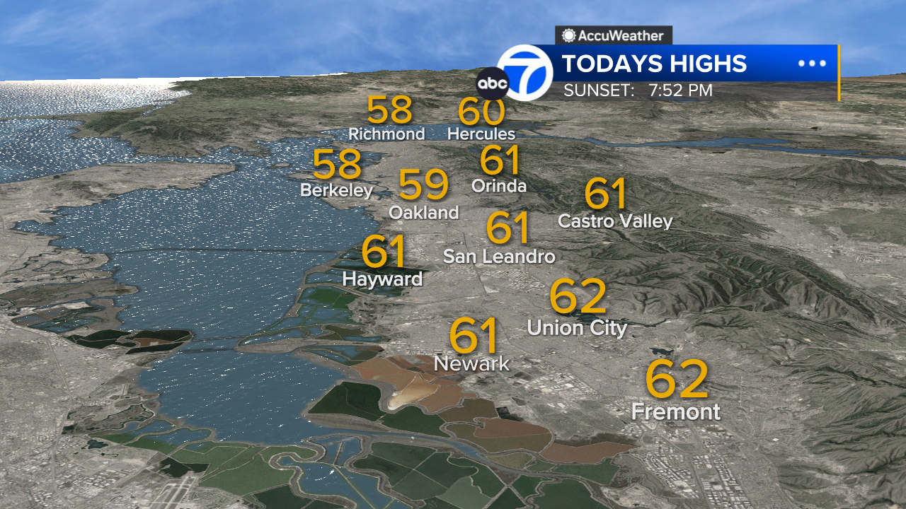
East Bay High Temps
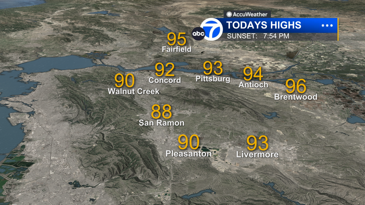
Inland East Bay High Temps
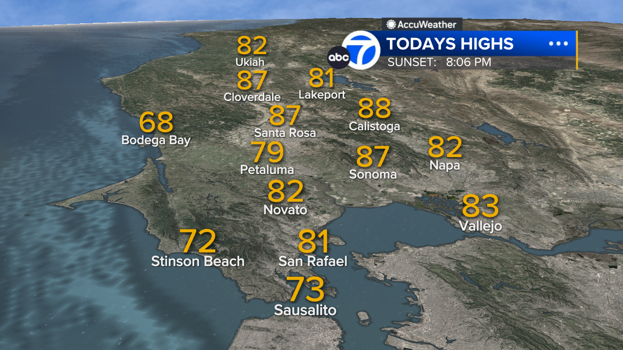
North Bay High Temps
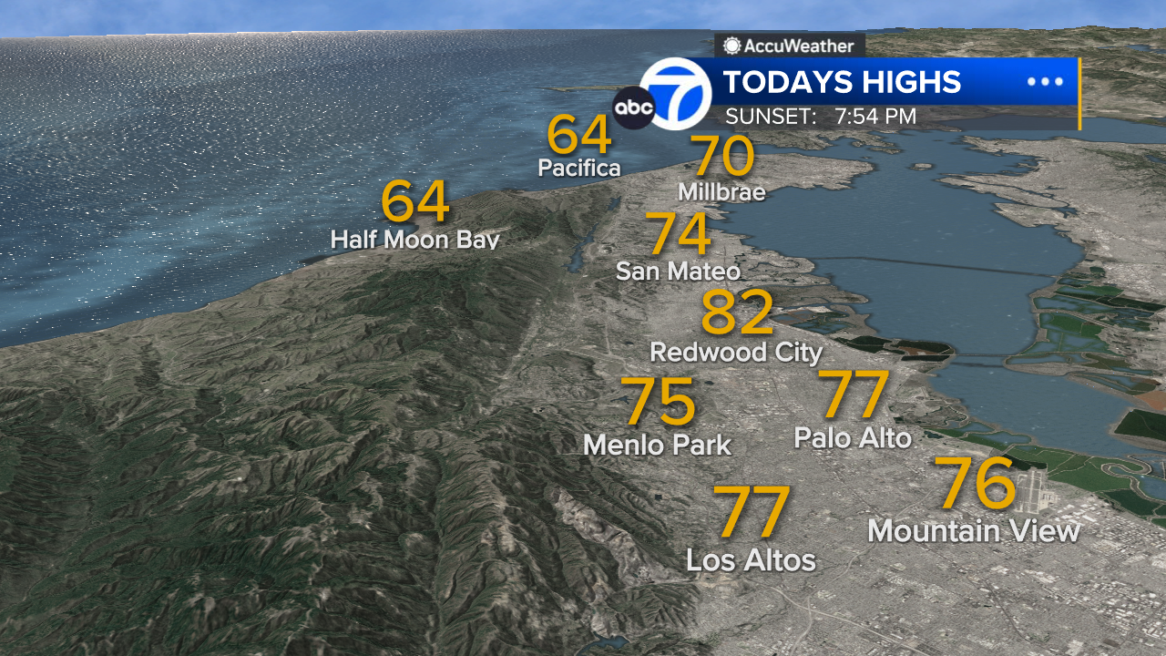
Peninsula High Temps
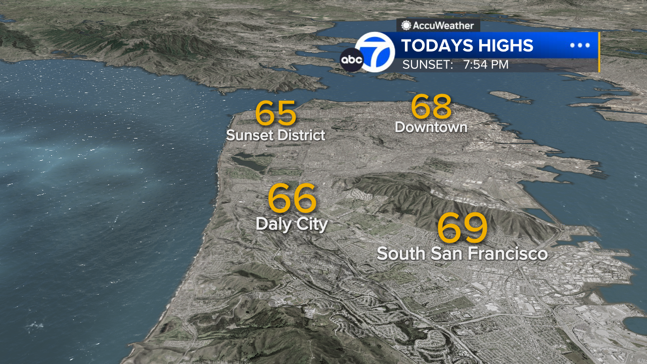
San Francisco High Temps
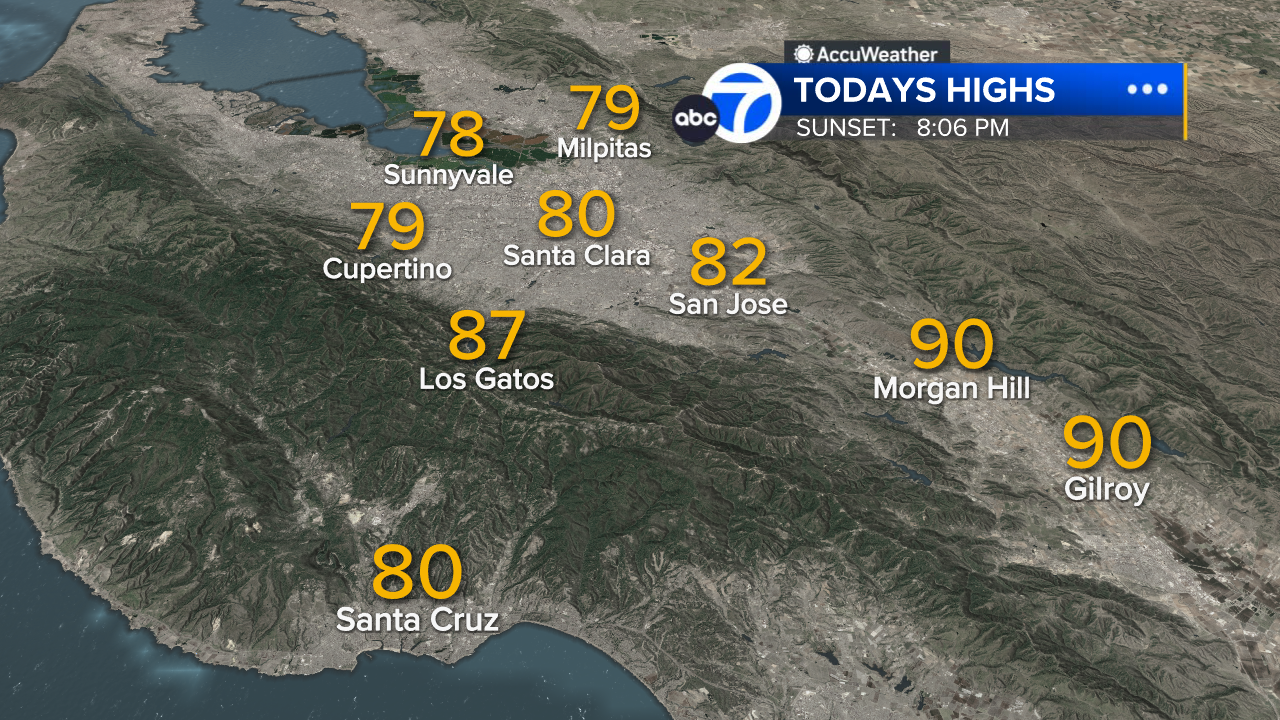
South Bay High Temps
- Download: ABC7 Accuweather app for iPhone and Android
- CA Weather Tracker: Reservoir levels, precipitation trends, snowpack totals
- Weather Radar: LiveDoppler7 radar images
- Weather Alerts: Current Watches and Warnings
- Share: Tag weather photos #ABC7Now
SHARE YOUR PHOTOS: We love seeing photos and videos from where you live! Share yours by posting with #abc7now. You must have taken the image/video or otherwise own all rights to it and agree that KGO-TV and its licensees can use, edit and distribute it without restriction in all media. Full terms: abc7news.com/share


