TIMELINE: Fort Funston has a long history of erosion


SAN FRANCISCO, Calif. (KGO) -- The location of the deadly landslide in San Francisco's Fort Funston has a long history of erosion dating back decades.
The exact spot where there slide occurred used to be a World War II gun battery designed to prevent Japanese forces from invading California.
In 1979, one of the deactivated 'Panama' gun mounts on the cliff collapsed into the ocean after the cliff eroded.
According to a report in "The Coast Defense Journal", the National Park Service studied the possibility of preserving the remaining mounts from erosion, but with cost projections well over $250,000 the NPS elected to let erosion claim the remaining mounts.
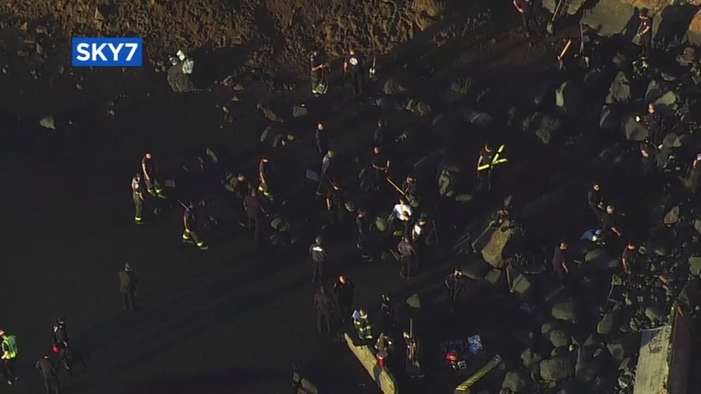
RELATED: Fire crews suspend search operations, moving to recovery after slide at Fort Funston
By 1997, all three gun mounts had slid off the cliff and landed on the beach below.
The concrete remnants of the gun mounts were actually still visible during rescue efforts by first-responders on Friday.
The U.S. Geological Survey has been studying erosion near the location of the deadly Fort Funston landslide for years.
Their research has documented several large landslides in the area including one in 1989.
That one measured at 100 feet high and contained 3,700 cubic yards of material.
It occurred about a half mile south of Friday's deadly landslide.
A more recent study in the Journal of Coastal Research compared erosion just a few hundred feet south of Friday's deadly landslide.
Aerial before-and-after photographs from 2002 to 2004 showed a net erosion of nearly 15,000 cubic yards of material.
Despite decades of erosion and several landslides, until Friday's deadly landslide no one had ever been hurt as a result of the changing geological landscape of Fort Funston.