

AccuWeather Forecast: Cloudy skies, chances of occasional drizzle to remain over next few days


Takeaway of the Day
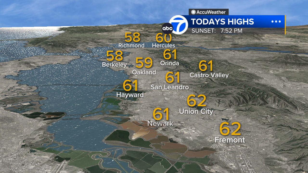
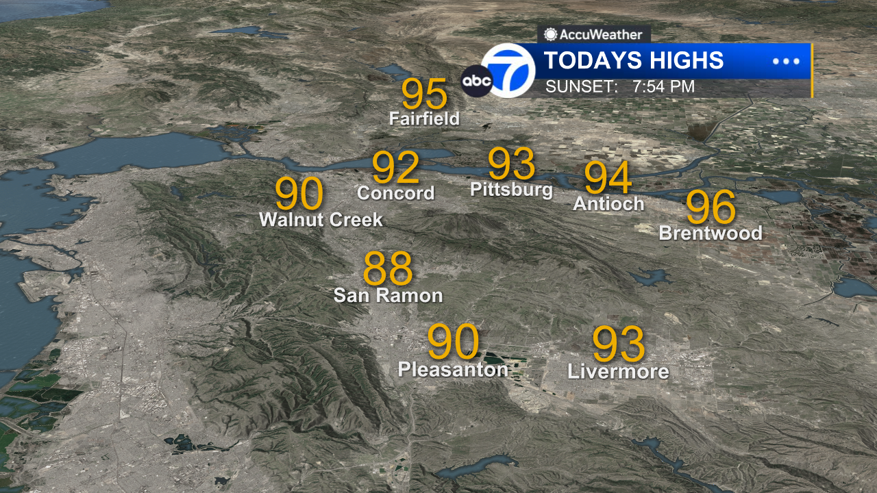
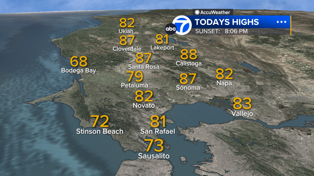
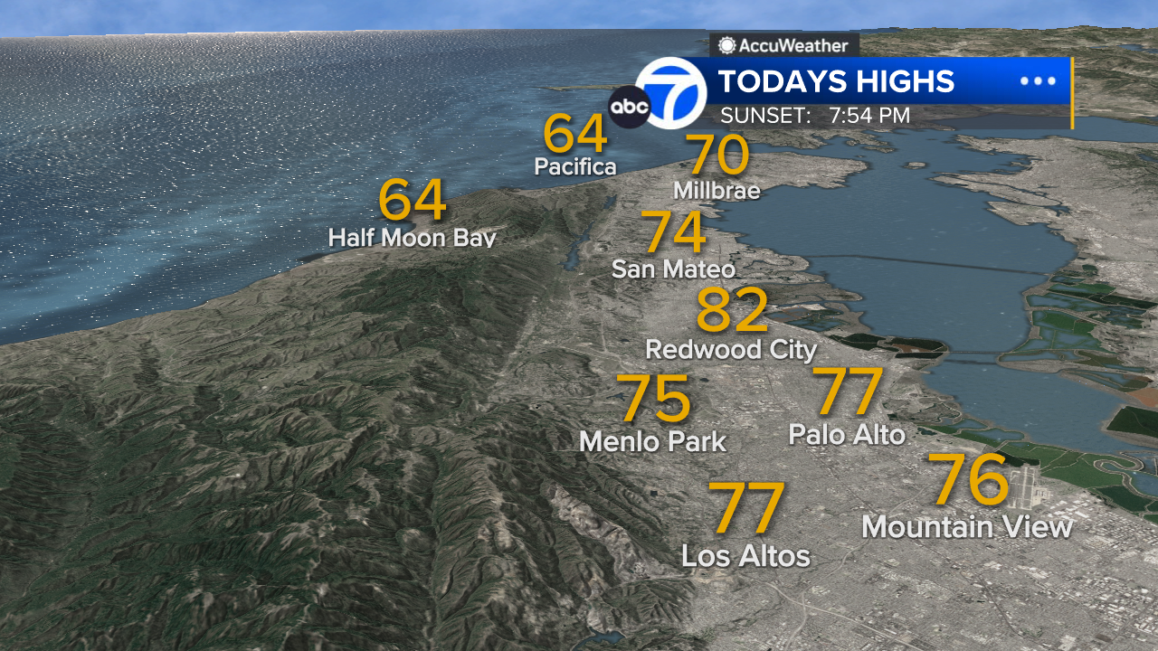
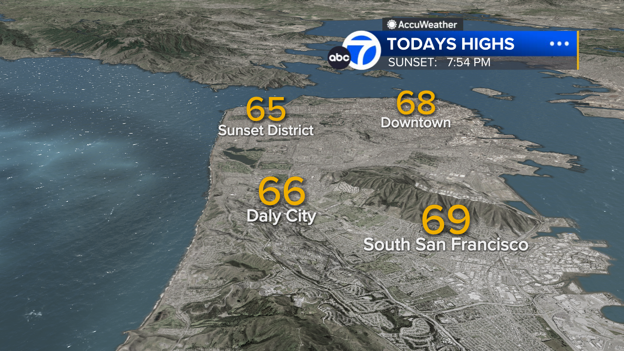
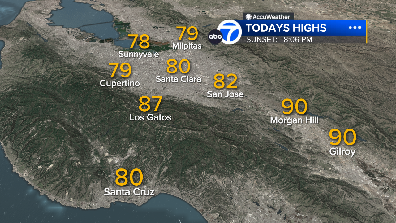
What a dramatic change from yesterday's record warmth! Following two days of summerlike heat across the Bay Area, today's temperature readings are 15 to 25 degrees lower than yesterday's. That is a sharp and stunning 24-hour change. Where yesterday's high temperatures were 84 to 88 degrees, today's highs were 61 to 64. Clouds and cooling breezes will linger tonight, with a chance of patchy drizzle.
The Look Ahead
The next few days will bring partly to mostly cloudy skies, chances of occasional drizzle, and afternoon highs mainly in the low to mid 60s. This cooler pattern will continue through the weekend, and we can expect more impactful rain beginning Sunday and continuing into early next week.
7 Day Forecast

- Download: ABC7 Accuweather app for iPhone and Android
- CA Weather Tracker: Reservoir levels, precipitation trends, snowpack totals
- Weather Radar: LiveDoppler7 radar images
- Weather Alerts: Current Watches and Warnings
- Share: Tag weather photos #ABC7Now
SHARE YOUR PHOTOS: We love seeing photos and videos from where you live! Share yours by posting with #abc7now. You must have taken the image/video or otherwise own all rights to it and agree that KGO-TV and its licensees can use, edit and distribute it without restriction in all media. Full terms: abc7news.com/share
Related Topics
Related


