County Fire east of Lake Berryessa growing, only 2 percent contained

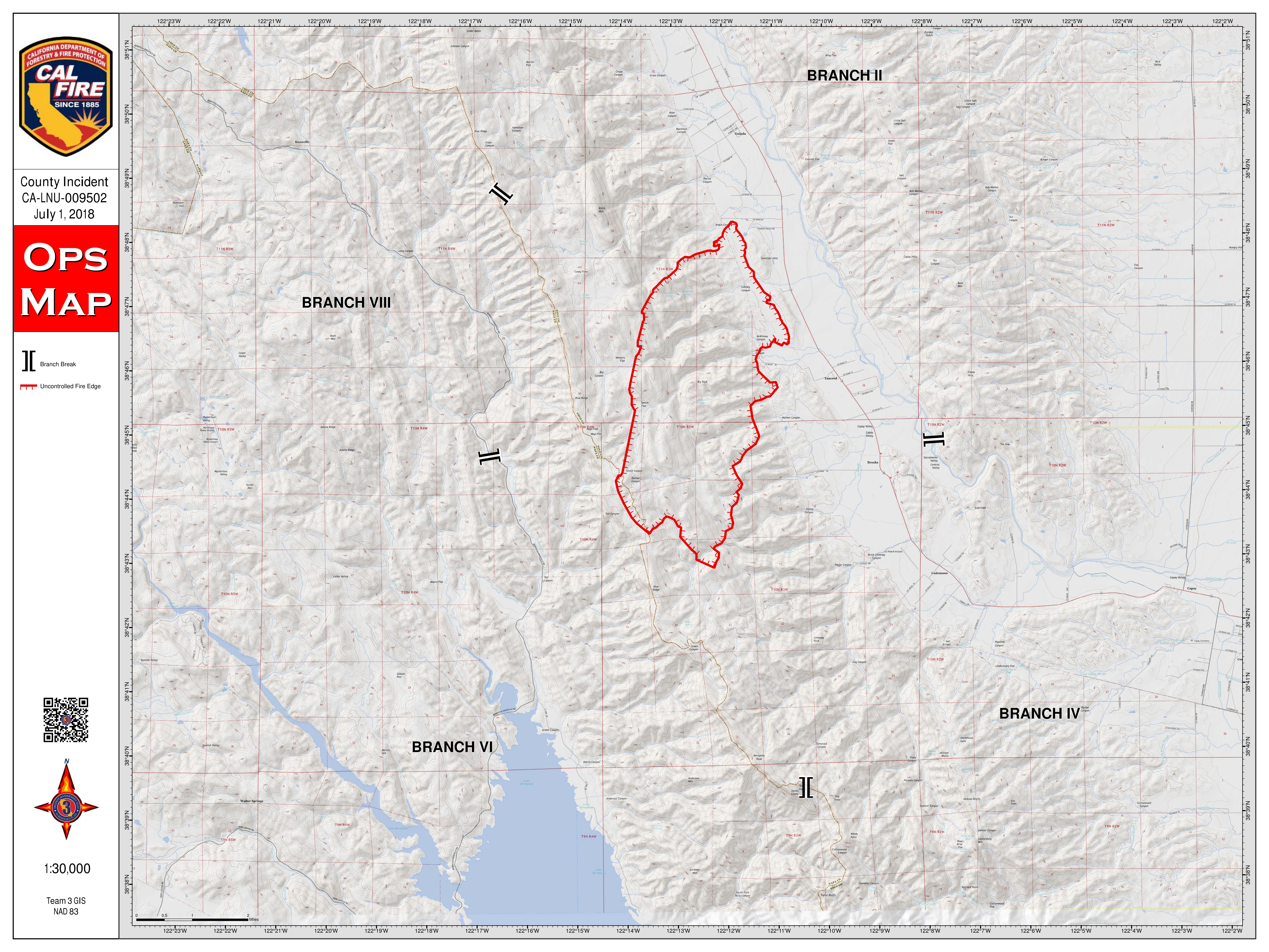
WINTERS, Calif. (KGO) -- The fire on the hills east of Lake Berryessa shows no sign of slowing down. In fact, what Cal Fire has dubbed the County Fire has grown significantly since it started on Saturday -- 32,500 acres so far.
No structures have been destroyed, but more than a hundred are threatened and the smoke, especially along Highway 16, is starting to take a toll.
MAP: A look at the 'County Fire' in Yolo County
"It's getting bad now. It's starting to be really bad. Headaches, yup. Definitely," said Kimberly Tacket of Yolo County.
Mandatory evacuation orders have been issued along Highway 128 west of Pleasants Valley Road and several nearby areas in Yolo County. Many heeded the warning. But others at Canyon Creek Resort, a motor home park east of Lake Berryessa, have chosen to stay put.
"What happens if I move today and tomorrow they say, 'oh the road is open again.' Then I lose my spot. I lose my money. I lose my time, my work and I don't like that," said Juliano Urbina, a guest at the resort.
"Today's my first day on vacation and I have 10 days off and I'm not going to ruin it," said Michael Brady, another resort guest, who chose to ignore the evacuation order.
Brad Gednalske, one of Canyon Creek's security workers, says he won't leave until everyone else does.
"I'm okay with that. If it gets bad enough and they come here and tell us we have to leave then I'm leaving," said Gednalske
RELATED: Mandatory evacuations ordered because of Pawnee Fire flare-up
Firefighters have been called in from all over California. Crews are dealing with high temperatures and shifting winds as they work to establish control lines.
"We're just going along the edge of the community with some dozers and crews and as the fire comes down off the hill, stopping it before it gets into the community," said Dave Soldavini of the U.S. Forest Service.
The fire is only 2 percent contained. Full containment is expected on Friday.
EVACUATION ORDERS, ROAD CLOSURES:
Mandatory evacuations:
Residences served by Highway 128, between Monticello Dam and Pleasant Valley Road.
North of Highway 128
South of County Road 23
East of Berryessa Knoxville Road
Residences served by Highway 128, between Monticello Dam and Pleasant Valley Road
Evacuation Advisory:
North of Quail Canyon Road
South of Highway 128
East of the Blue Ridge mountains
West of Pleasant Valley Road
For questions regarding Yolo County evacuations or advisories, please dial 2-1-1 For questions regarding Solano County evacuations or advisories please dial (707) 398-8261
Evacuation center: Guinda Grange Hall in the Community of Guinda 16487 Forest Ave. Guinda, CA 95637
Road closures:
Northbound County Road 87 from Highway 128, Berryessa Knoxville Road, from the Pope Creek Bridge to the Napa/Lake County line, Eastbound Highway 128 at Markley Resort, Westbound Highway 128 at Pleasant Valley Road, Pleasant Valley Road, South from Highway 128 remains open to serve traffic into Solano County
The fire sent smoke across the Bay Area, as far west as Petaluma and as far south as San Francisco and Redwood City, according to the National Weather Service in San Francisco.
CAL FIRE map of the "County Fire"


