AccuWeather Forecast: Showers end by morning, temperatures remain low


Takeaway of the Day
This has been a rainy, windy, and very chilly day for early May. Many Bay Area locations have received more than an inch of rain, with wind gusts over 30 miles per hour, and high temperatures barely reaching into the mid-50s. Rain is beginning to taper off as evening approaches, but it's still rather windy and chilly. It may be a few days before temperatures rebound to typical May levels.
TIMELINE: Storm to bring May rain to Bay Area Saturday
WINTER STORM WARNING
11 a.m. to 8 a.m. Sunday above 5,000 feet.
5-8" of snow around Lake Tahoe, 8-12" over higher Sierra passes.
Winds gusting to 55 mph.
The Look Ahead
Tonight's showers will end by early morning, but even though the next two days will be mostly sunny, temperatures will remain far below normal for the month of May. However, a major warmup will begin on Tuesday, with afternoon temperatures soaring to summerlike levels Wednesday through Friday.
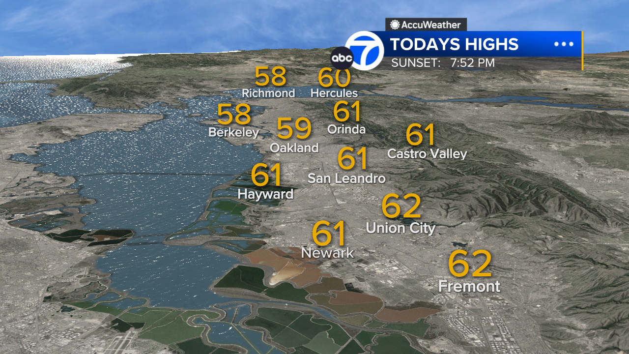
East Bay High Temps
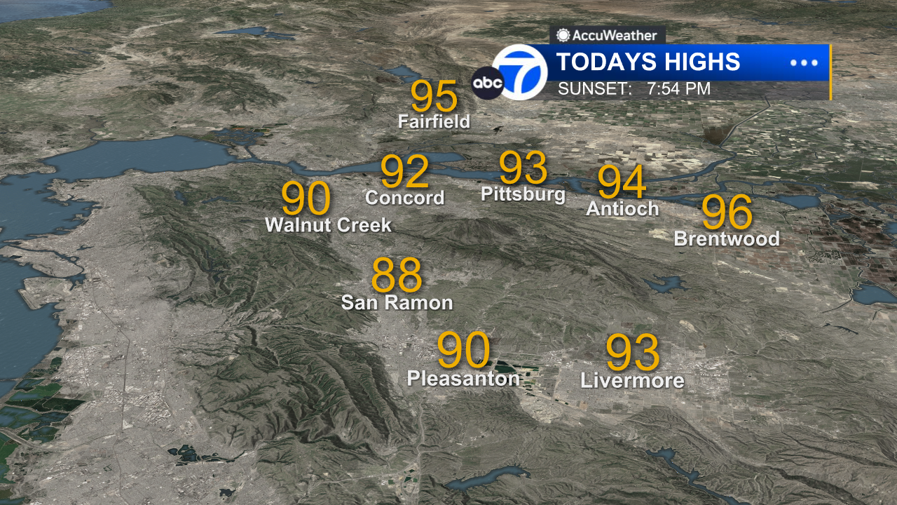
Inland East Bay High Temps
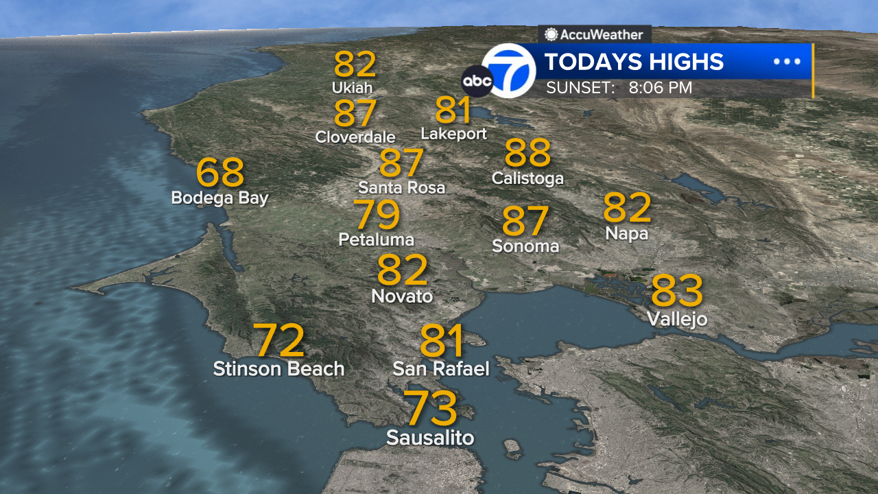
North Bay High Temps
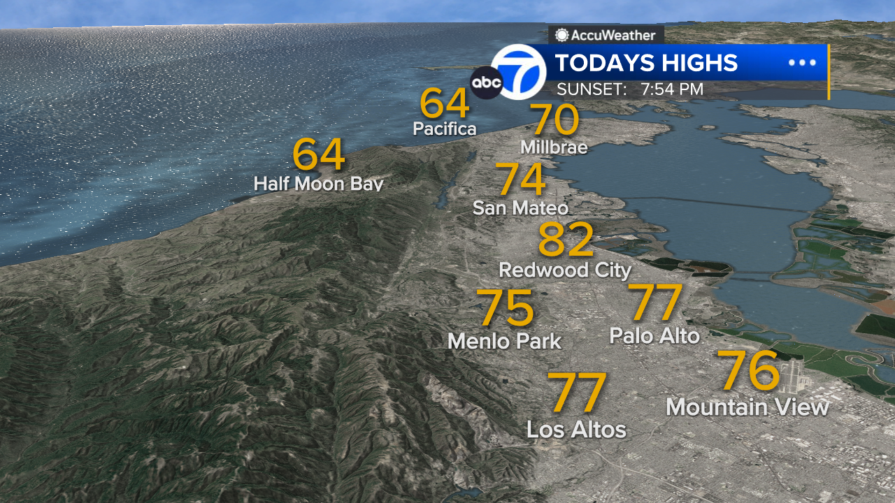
Peninsula High Temps
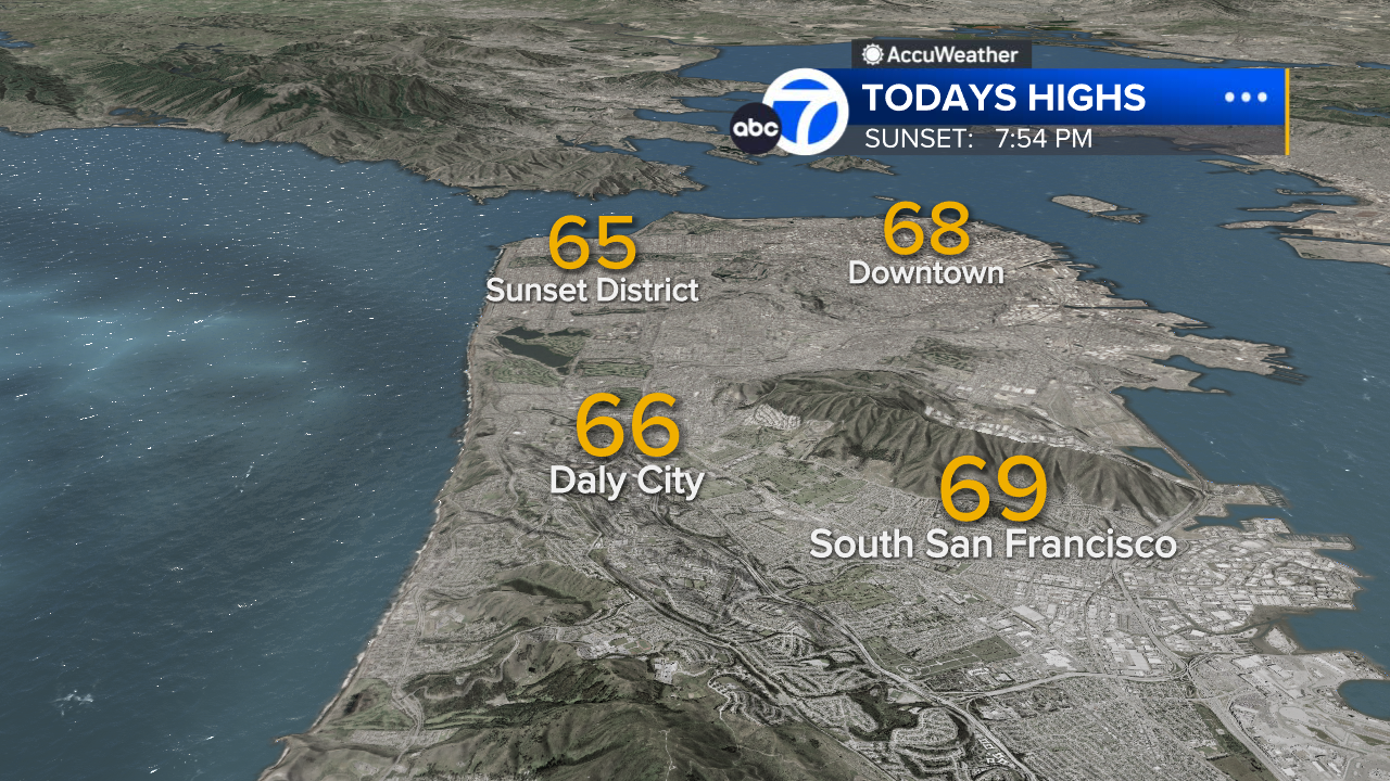
San Francisco High Temps
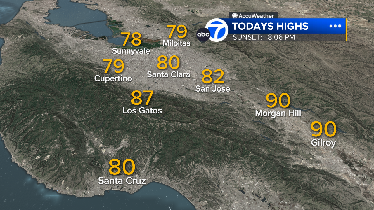
South Bay High Temps
- Download: ABC7 Accuweather app for iPhone and Android
- CA Weather Tracker: Reservoir levels, precipitation trends, snowpack totals
- Weather Radar: LiveDoppler7 radar images
- Weather Alerts: Current Watches and Warnings
- Share: Tag weather photos #ABC7Now
SHARE YOUR PHOTOS: We love seeing photos and videos from where you live! Share yours by posting with #abc7now. You must have taken the image/video or otherwise own all rights to it and agree that KGO-TV and its licensees can use, edit and distribute it without restriction in all media. Full terms: abc7news.com/share


