RELATED: Mendocino Complex Fires now bigger than Los Angeles
[Ads /]
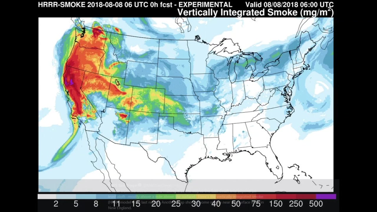
A map from the National Weather Service shows the smoke spreading across the country.
Thankfully for those on the East Coast, the smoke is more than a mile above the surface, so nobody can see or smell it. But it's rare that smoke makes its way across the country.
RELATED WILDFIRE STORIES & VIDEOS:
- MAPS: Wildfires burning across California
- The latest evacuation orders for Shasta County's Carr Fire, Mendocino County's Complex Fire
- PHOTOS: Massive Carr Fire tears through Shasta County
- How to help Carr Fire victims in Redding and Shasta County, California
- Photos from the wildfires across California
- VIDEO: What it's like to fly over the Carr Fire in a Calif. National Guard plane
- VIDEO: Drive through Carr Fire near Redding reveals apocalyptic scenes
- VIDEO: Firefighters get brief rest in neighbor's yard during 'apocalyptic' Carr Fire in Shasta County
- VIDEO: New look at destruction from Carr Fire in Redding
- Most destructive California wildfires in history
- How to prepare for a wildfire evacuation
- PG&E may cut electricity during high fire danger, are you prepared?
- The difference between containing and controlling a wildfire
- These aircraft are on the front lines of the fight against California wildfires
- Wildfire masks: How to best protect yourself from smoke during a fire
- How wildfire smoke can impact your health
- How to sign up for emergency alerts where you live
- Surviving a long-term power outage
- Safety tips to remember when returning home after wildfire
- DIY: How to make a pet carrier in case of emergency
- How to prepare your pets in case of disaster
[Ads /]
[Ads /]

