AccuWeather Forecast: Partially clear overnight, rain returns tomorrow

Takeaway of the Day
The Bay Area is finally getting a break from flooding rain and gusty wind. After a few morning showers, the sun broke through around midday, and this afternoon has been mainly dry. However, the sunny breaks have not produced much warmth. Afternoon highs have generally been below 60 degrees. We can expect further clearing tonight, but another rainy pattern will begin tomorrow.
WINTER STORM WARNING for the west slopes of the Sierra Nevada until 4 p.m. Tuesday above 5,500 feet. 1-4 feet above 7,000 feet.
3-8" of snow expected below 7,000 feet for South Lake Tahoe. Gusty winds to 55 MPH.
FOLLOW LIVE STORM UPDATES HERE.
LIVE: Track rain in San Francisco Bay Area with Live Doppler 7
The Look Ahead
Partial clearing overnight will give way to morning showers tomorrow and areas of steadier rain in the afternoon and evening. This next storm is a light Level 1 on the exclusive ABC7 Storm Impact Scale, and it will be followed by two more rainy days on Monday and Tuesday. These will not be strong storms, but the three days of rain Sunday through Tuesday will fall on already saturated soil--so be on the lookout for storm alerts and possible flood advisories from the ABC7 News Weather Department.
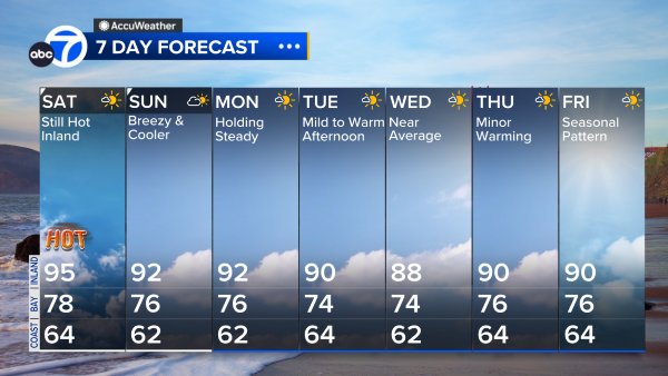
7 Day Forecast
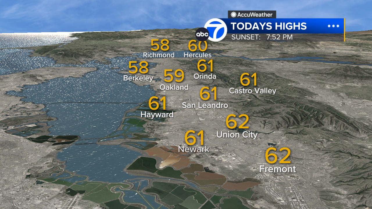
East Bay High Temps
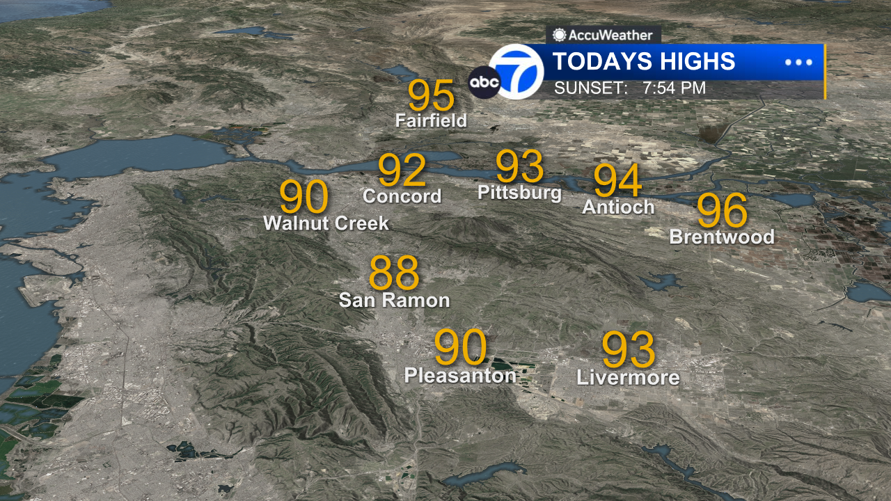
Inland East Bay High Temps
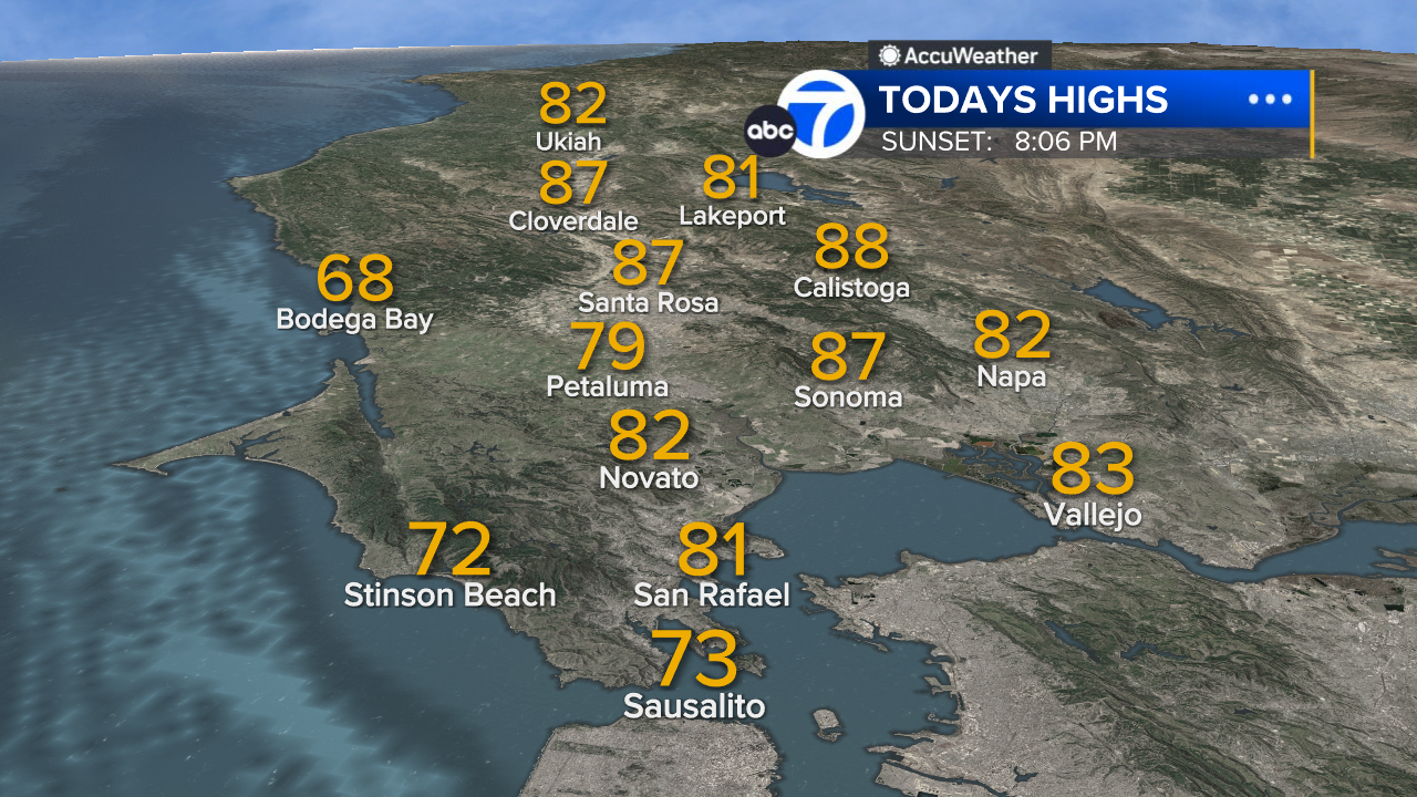
North Bay High Temps
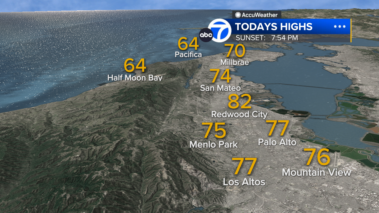
Peninsula High Temps
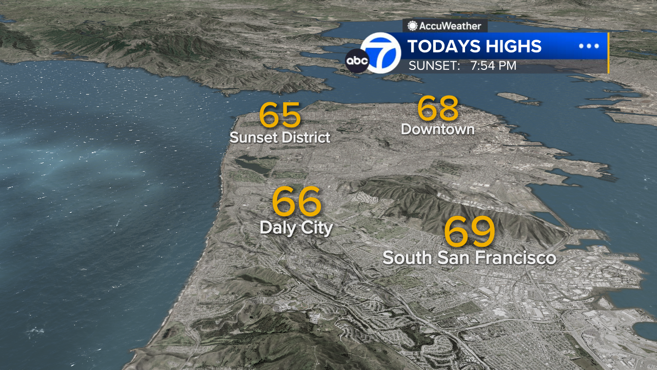
San Francisco High Temps
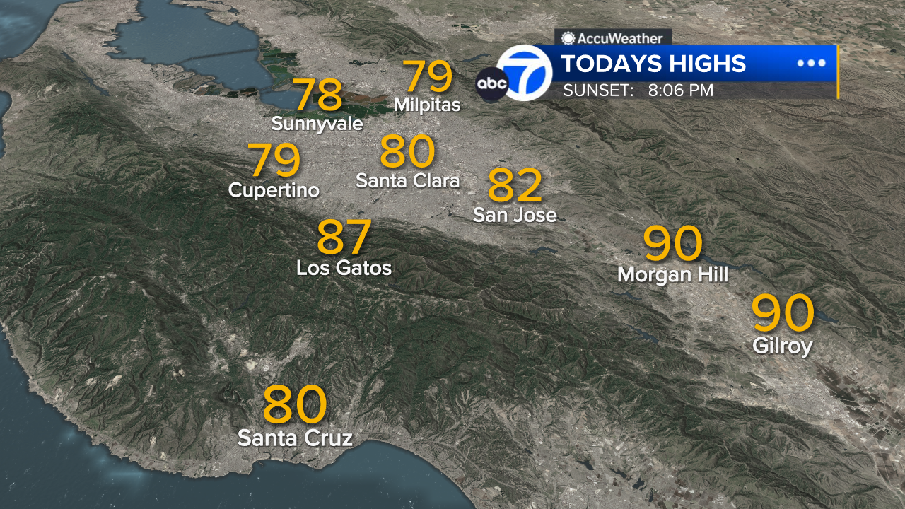
South Bay High Temps
- Download: ABC7 Accuweather app for iPhone and Android
- CA Weather Tracker: Reservoir levels, precipitation trends, snowpack totals
- Weather Radar: LiveDoppler7 radar images
- Weather Alerts: Current Watches and Warnings
- Share: Tag weather photos #ABC7Now
SHARE YOUR PHOTOS: We love seeing photos and videos from where you live! Share yours by posting with #abc7now. You must have taken the image/video or otherwise own all rights to it and agree that KGO-TV and its licensees can use, edit and distribute it without restriction in all media. Full terms: abc7news.com/share


