Incredible satellite imagery shows never-ending parade of storms that hit CA for 6 straight days


SAN FRANCISCO (KGO) -- Incredible satellite imagery shows the never-ending parade of storms that hit California over the span of six days.
The video is made up of images from GOES-18 which is one of several weather satellites operated by the National Oceanic and Atmospheric Administration (NOAA).
VIDEO: Here's before-and-after look at hardest-hit areas in Capitola, Santa Cruz
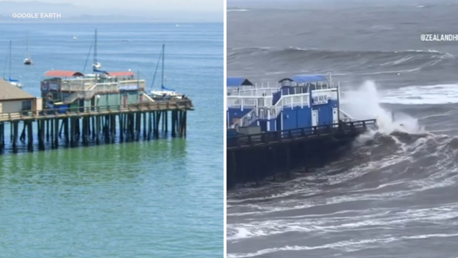
It shows the barrage of atmospheric river storms that have dumped rain and snow on California, cutting power to thousands, swamping roads, toppling trees, unleashing debris flows and triggering landslides.
As of Monday San Francisco International Airport (SFO) has received 20.3 inches of rain since Oct. 1, when California typically begins recording rainfall for the year. The average for the "water year" is 19.6 inches, "so we've surpassed the yearly total with 8 more months to go," the San Francisco weather service office tweeted.
The Associated Press contributed to this article.