AccuWeather Forecast: Warmer temps return this afternoon as sun continues into weekend
Takeaway of the Day
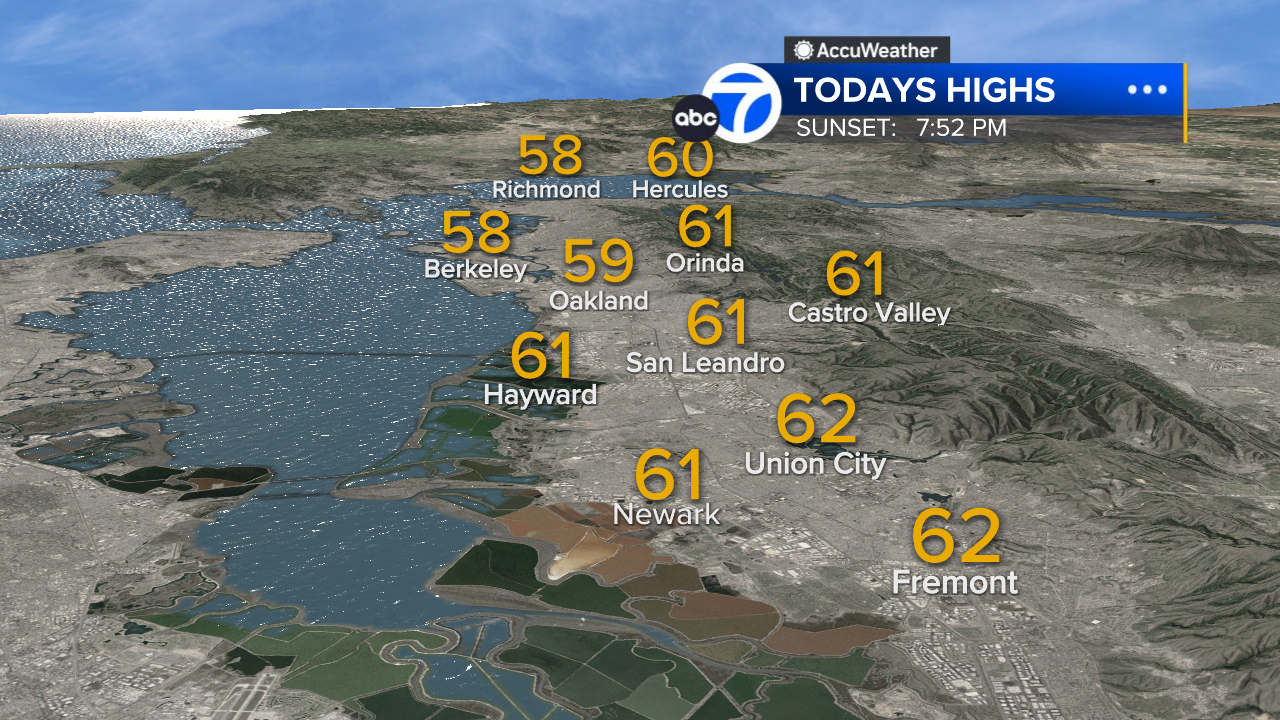
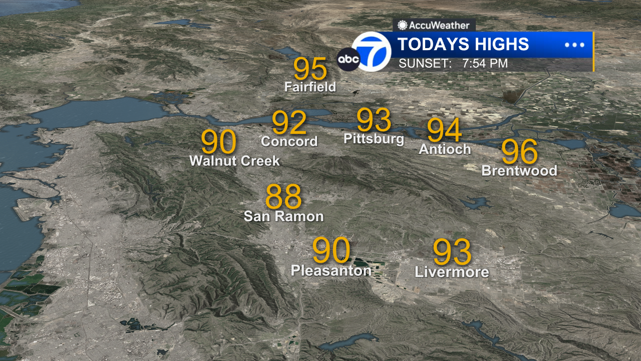
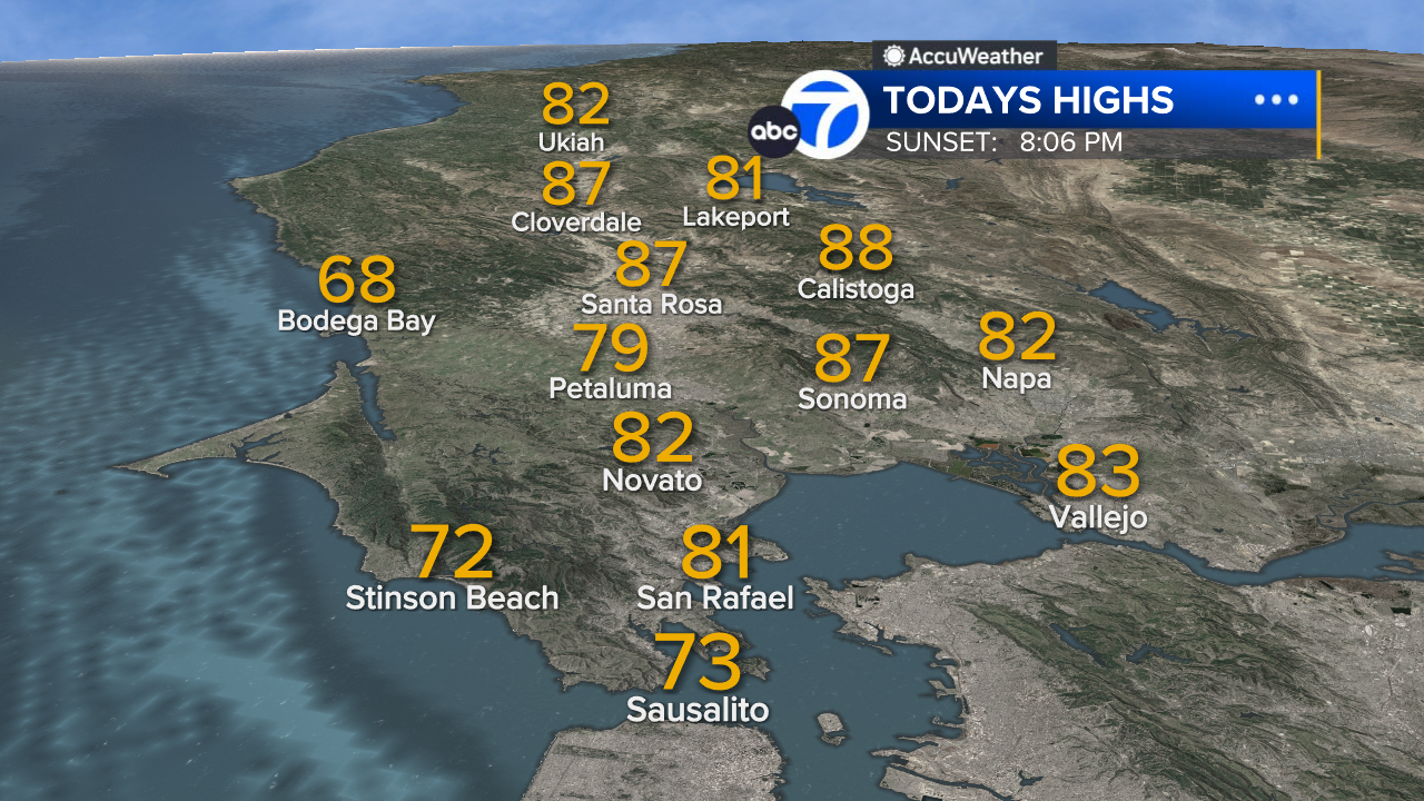
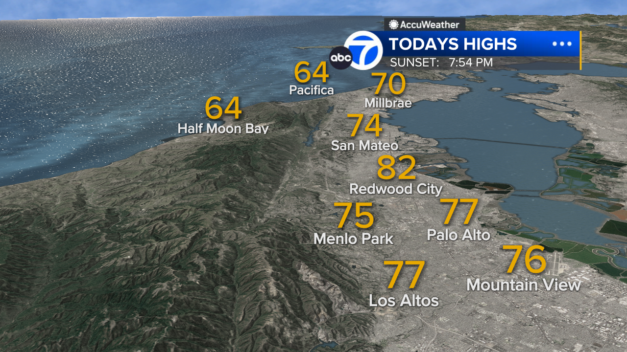
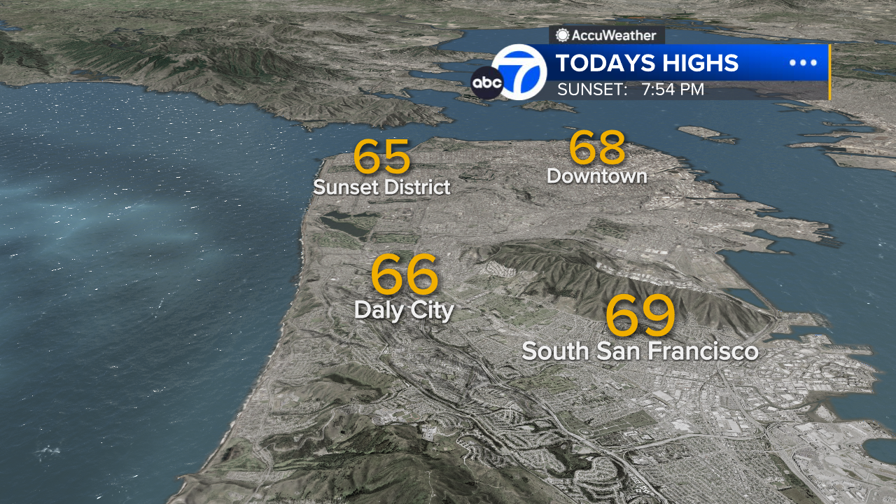
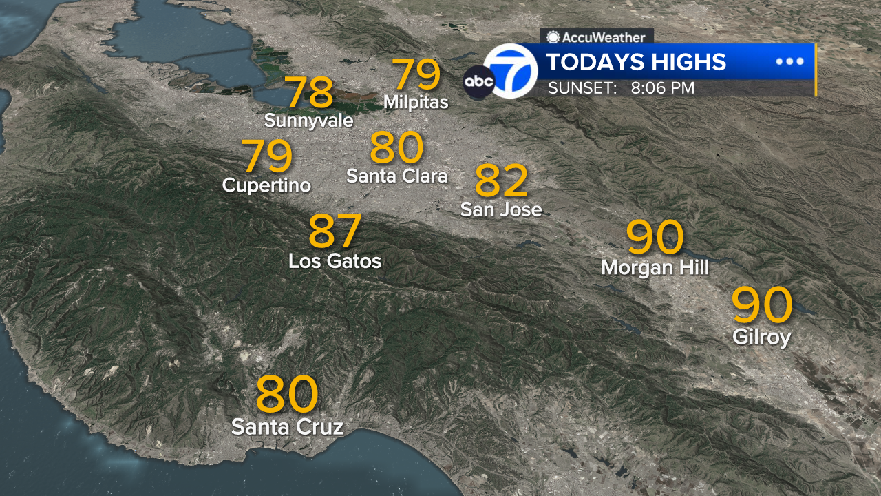
Warmer weather returns this afternoon. Morning clouds will depart quicker (than in days past) for sunny skies and highs will range from the upper 50s to the upper 70s.
The Look Ahead
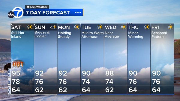
Mild and sunny weather continues into the weekend. For Easter Sunday, it will be dry for any egg hunts outside with afternoon highs in the 60s & 70s. Warm weather continues Monday before chilly air returns Wednesday.
7 Day Forecast
- Download: ABC7 Accuweather app for iPhone and Android
- CA Weather Tracker: Reservoir levels, precipitation trends, snowpack totals
- Weather Radar: LiveDoppler7 radar images
- Weather Alerts: Current Watches and Warnings
- Share: Tag weather photos #ABC7Now
SHARE YOUR PHOTOS: We love seeing photos and videos from where you live! Share yours by posting with #abc7now. You must have taken the image/video or otherwise own all rights to it and agree that KGO-TV and its licensees can use, edit and distribute it without restriction in all media. Full terms: abc7news.com/share
Copyright © 2025 KGO-TV. All Rights Reserved.


