

AccuWeather Forecast: Cool and cloudy through Saturday


Takeaway of the Day
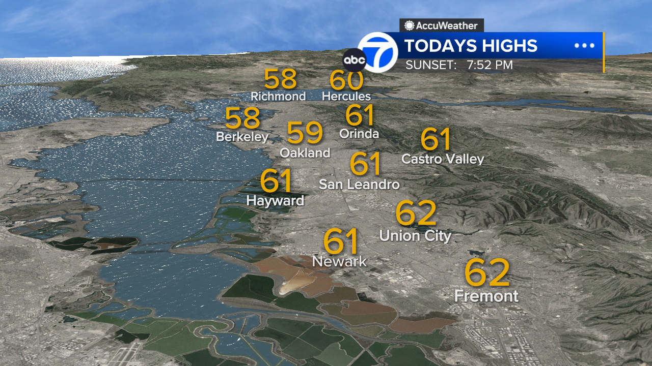
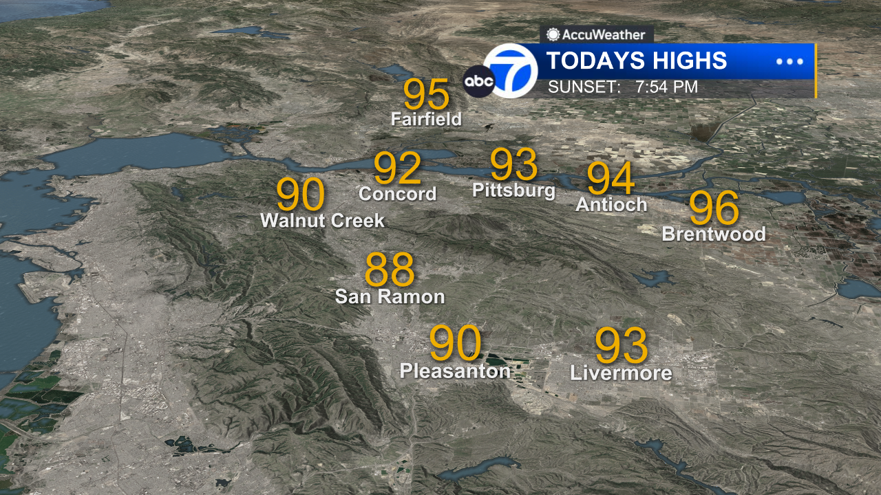
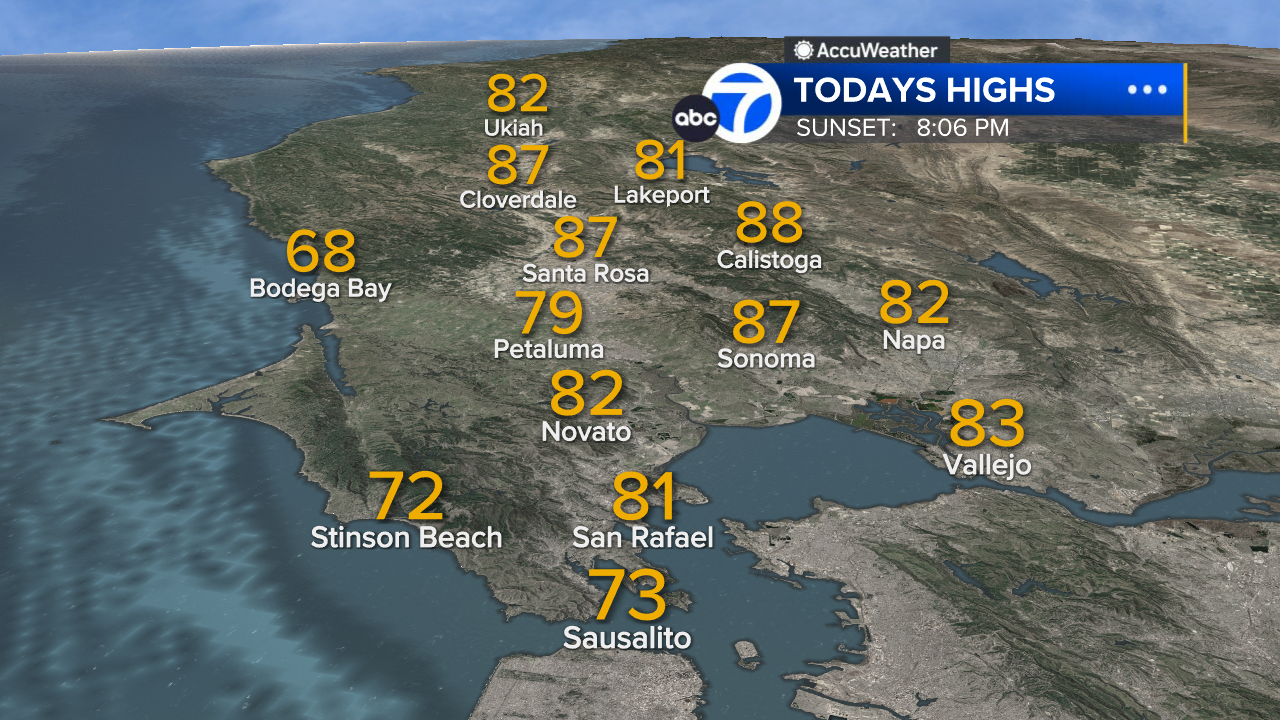
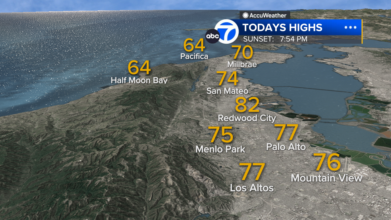
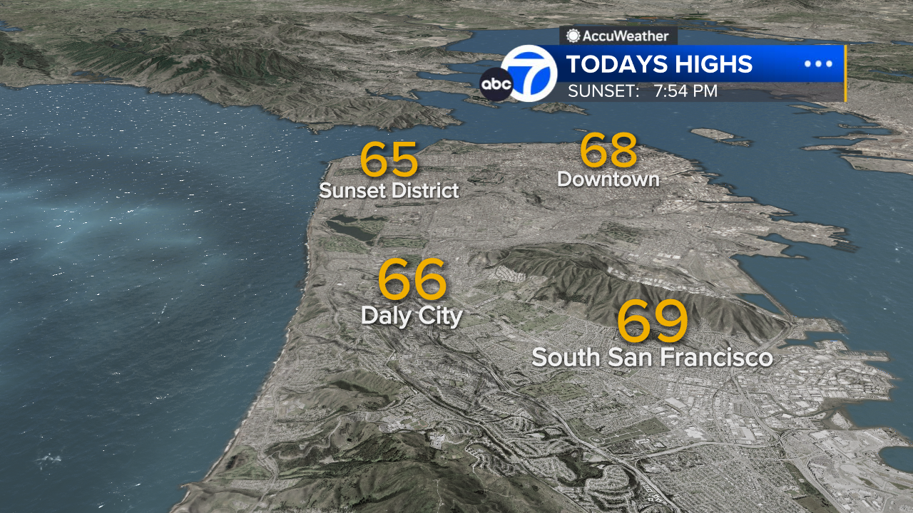
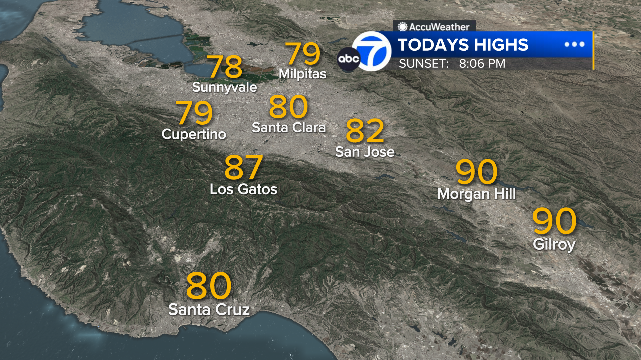
Today marked the beginning of a cloudier, windier, and cooler weather pattern around the Bay Area. Afternoon temperatures are ranging about 5 to 14 degrees lower than yesterday--and, as of 2:30 p.m., only the farthest inland locations were reporting temperatures higher than 64 degrees. We have brisk onshore winds contributing to a deepening marine layer, and there are even a few patches of light drizzle near the coast.
The Look Ahead
The next three days will bring a continuation of the cloudier and cooler weather that arrived today, and there is even a chance of light showers late Friday and early Saturday. However, the second half of the weekend will bring a rapid return to more spring-like weather. Sunday will be sunny and warmer, with highs ranging from mid-60s near the bay to around 70s degrees inland. This warming trend will continue into early next week, with highs ranging from mid-70s near the bay to lower 80s inland.
7 Day Forecast

- Download: ABC7 Accuweather app for iPhone and Android
- CA Weather Tracker: Reservoir levels, precipitation trends, snowpack totals
- Weather Radar: LiveDoppler7 radar images
- Weather Alerts: Current Watches and Warnings
- Share: Tag weather photos #ABC7Now
SHARE YOUR PHOTOS: We love seeing photos and videos from where you live! Share yours by posting with #abc7now. You must have taken the image/video or otherwise own all rights to it and agree that KGO-TV and its licensees can use, edit and distribute it without restriction in all media. Full terms: abc7news.com/share
Related Topics
Related


