Parade of fire trucks, firefighters battle County Fire in Guinda


GUINDA, Calif. (KGO) -- As the poster on the window of a corner store reads, they had planned a tiny Fourth of July parade in Guinda, Wednesday. "The Tiniest."
What they got, instead, turned out larger and certainly more urgent.
"Now we have a different kind of parade. Fire Engines and fire resources," said store owner Wyatt Cline.
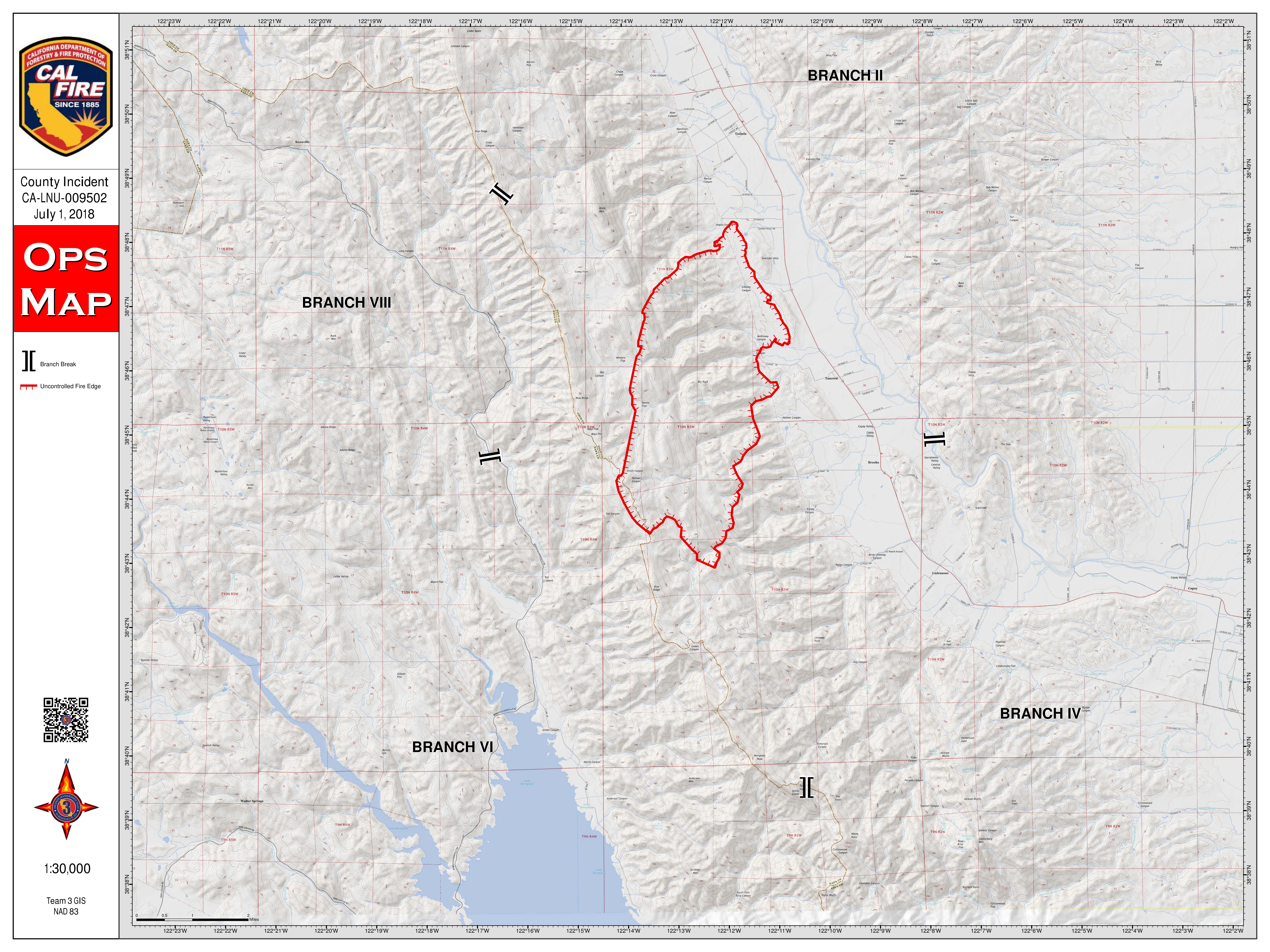
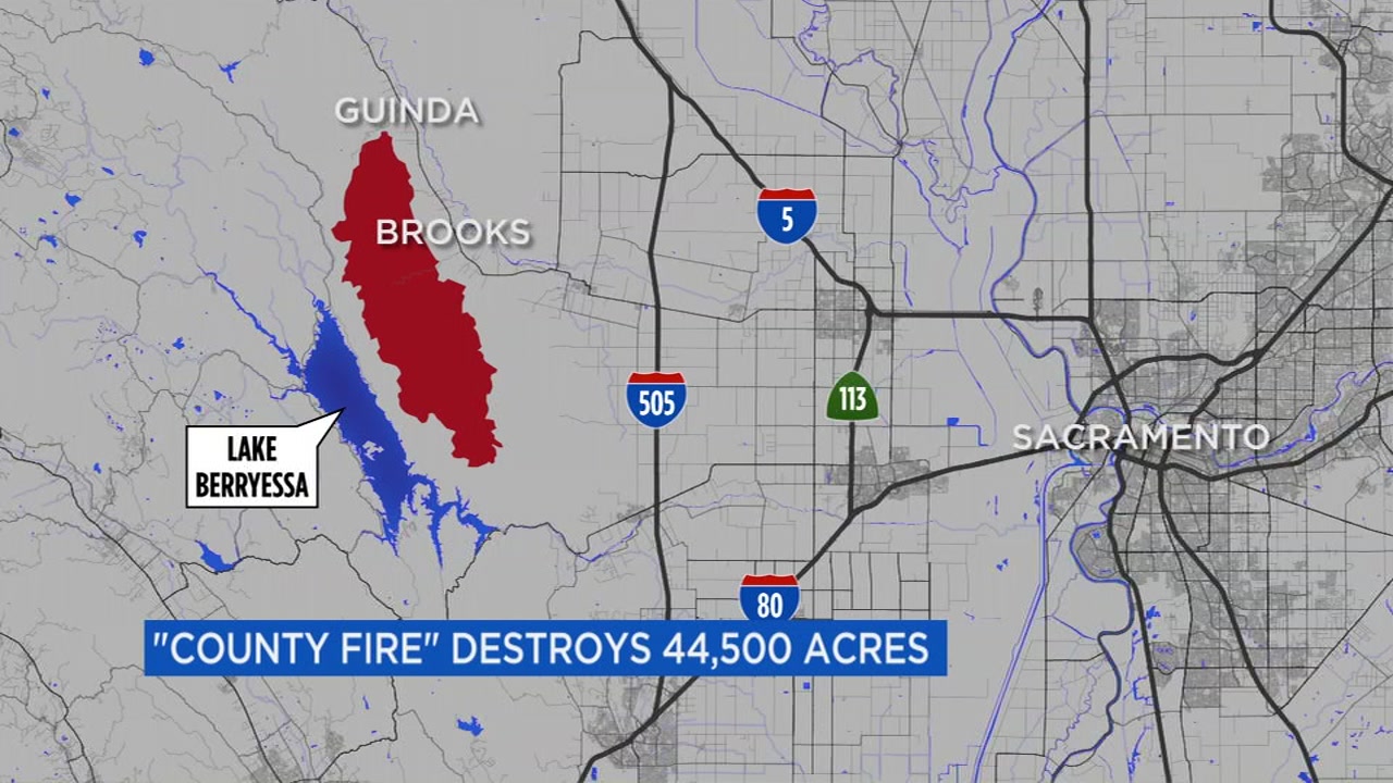
MAPS: A look at the 'County Fire' in Yolo County
It manifested along the northern-most, advancing line of the County Fire, today, in an impressive show of force and aerial skills. A platoon of helicopters attacked new hotspots in smoke so thick that it challenged the margins of acceptable visibility.
From a mile away, there were times when they disappeared into the billowing blackness.
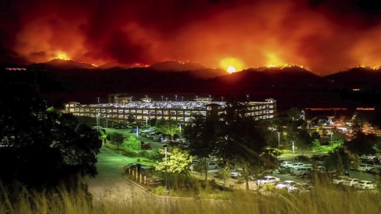
The fire burning near Lake Berryessa has grown to 82,700 acres in the rough, mountainous terrain of Yolo and Lake counties and is now threatening over 1,000 structures. So far, the fire is 25 percent contained.
With the blaze burning in steep, almost inaccessible terrain, Cal Fire took advantage of a relative break in the weather to push back flames that threatened the valley floor and this small, closely-knit town. Few people, if any, evacuated.
PHOTOS: County Fire burning near Lake Berryessa
"Unless the engine parked on our property says, 'Flame, get out,' I am going to stay," said resident Susan Muller.
"I have never seen a fire like this," added Anita Jayne-Eubank.
Or a battle like it. Chopper after chopper dipping into Cache Creek for water, then returning to the flames, making drops, and all in a thick blanket of smoke.
In the almost 150 years of Guinda, it's a July 4 unlike any other - one they hope to never see the likes of, again.
EVACUATION ORDERS, ROAD CLOSURES:
Mandatory evacuations:
Residences served by Highway 128, between Monticello Dam and Pleasant Valley Road.
West of State Highway 16, to Berryessa Knoxville Road, South of Old County Road 40, and North of County Road 53
North of Highway 128
South of County Road 23
East of Berryessa Knoxville Road
West of County Road 89, South of the community of Esparto, however agricultural equipment will be permitted
Evacuation Advisory:
North of Quail Canyon Road
South of Highway 128
East of the Blue Ridge mountains
West of Pleasant Valley Road
East of Capell Valley Road
North of State Highway 128 from Capell Valley Road, East to the Napa County line
North of State Highway 128 in Yolo County, not including the City of Winters
South of County Road 23
East of Berryessa Knoxville Rod
West of County Road 89, South of the community of Esparto, however agricultural equipment will be permitted
For questions regarding Yolo County evacuations or advisories, please dial 2-1-1 For questions regarding Solano County evacuations or advisories please dial (707) 398-8261
Evacuation center: Guinda Grange Hall in the Community of Guinda 16487 Forest Ave. Guinda, CA 95637
Road closures:
Northbound County Road 87 from Highway 128, Berryessa Knoxville Road, from the Pope Creek Bridge to the Napa/Lake County line, Eastbound Highway 128 at Markley Resort, Westbound Highway 128 at Pleasant Valley Road, Pleasant Valley Road, South from Highway 128 remains open to serve traffic into Solano County
Cooperating Agencies:
California Department of Corrections and Rehabilitation, Cal OES, California Highway Patrol, California Conservation Corps, Yolo County OES, Yolo County Sheriff, Solano County Sheriff, Napa County Sheriff, PG&E, Bureau of Indian Affairs, Yocha Dehe Wintun Nation, Bureau of Land Management, United States Forest Service, and California National Guard.
The fire sent smoke across the Bay Area, as far west as Petaluma and as far south as San Francisco and Redwood City, according to the National Weather Service in San Francisco.
CAL FIRE map of the "County Fire"


