

AccuWeather Forecast: Breezy winds increase fire danger overnight


Takeaway of the Day
It's a mild and sunny afternoon across the Bay Area, and a breezier pattern is developing as evening approaches.
As winds increase tonight and shift to a northeasterly flow and as the air gets drier, we can expect elevated fire danger overnight. However, there is no Red Flag Warning for high fire danger, as winds will diminish by mid-morning, and fire danger will diminish as well.
The Look Ahead
We can expect a generally mild-to-warm range of temperatures over the next few days, with a slight increase in clouds as the weekend approaches. And there will be chances of drizzle late Sunday into early Monday. Any measurable rainfall is likely to amount to only one or two hundredths of an inch, and the chances of drizzle appear confined mainly to the North Bay.
As for the high temperature range over the next seven days, a cooling trend will develop on Sunday and continue well into next week.
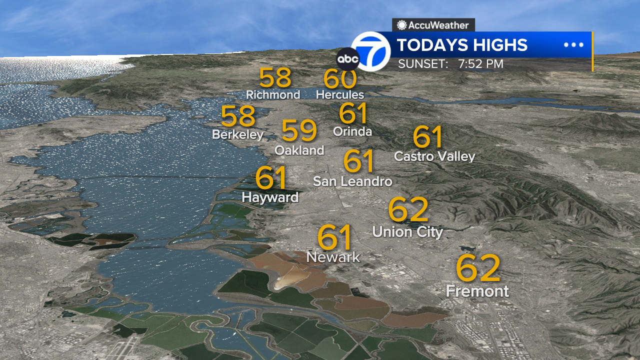
East Bay High Temps
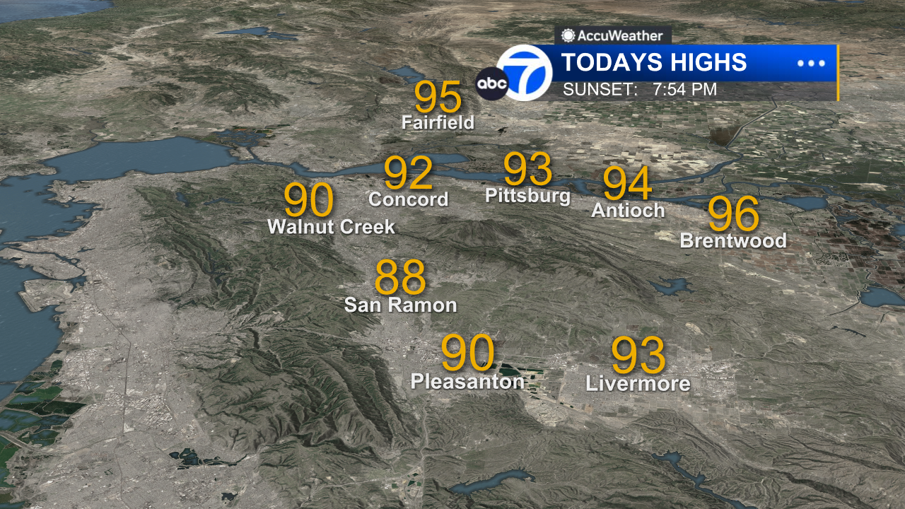
Inland East Bay High Temps
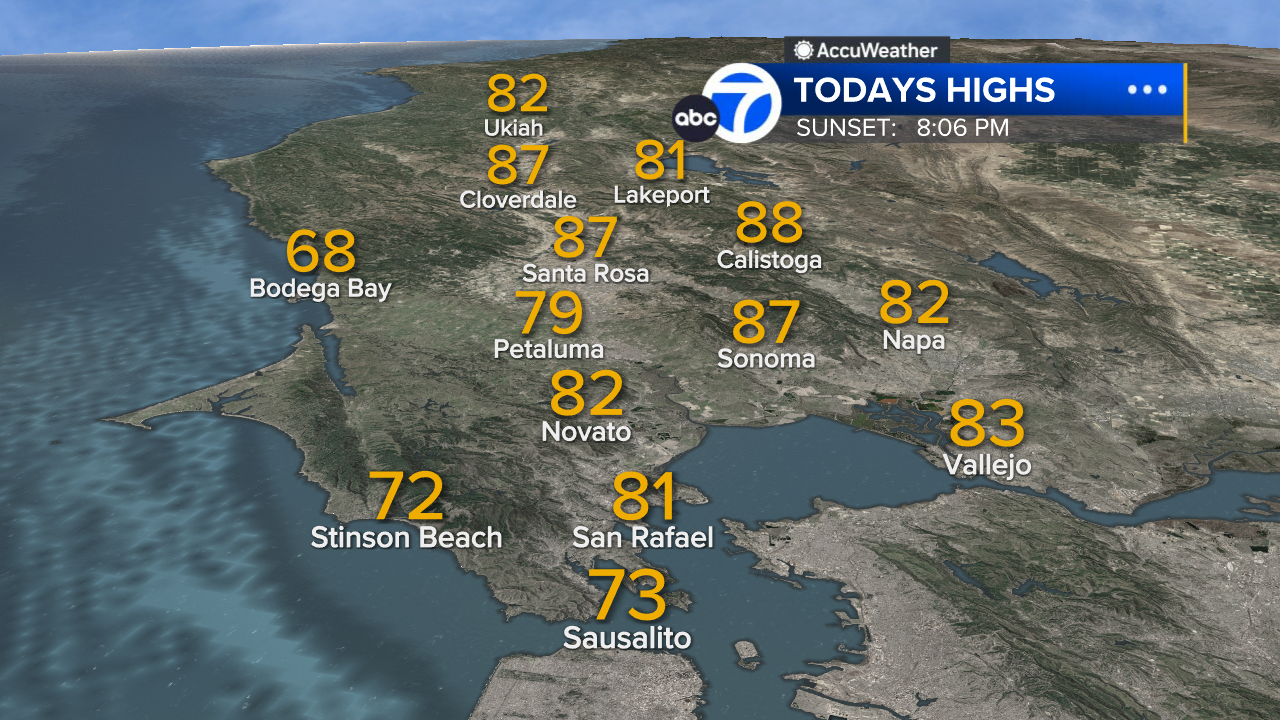
North Bay High Temps
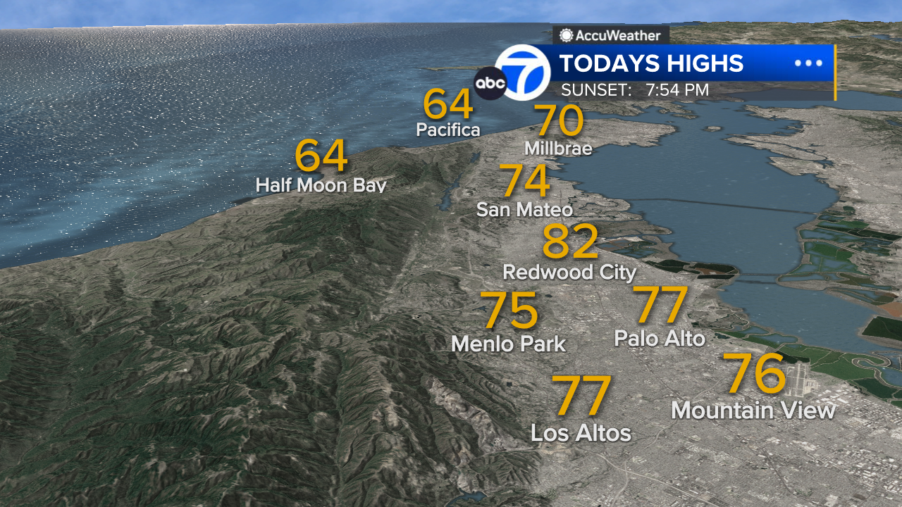
Peninsula High Temps
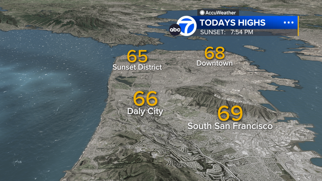
San Francisco High Temps
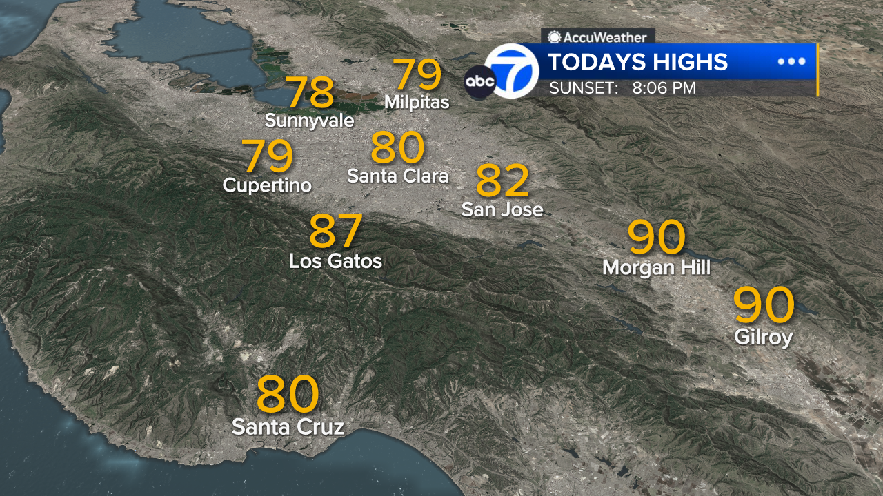
South Bay High Temps
- Download: ABC7 Accuweather app for iPhone and Android
- CA Weather Tracker: Reservoir levels, precipitation trends, snowpack totals
- Weather Radar: LiveDoppler7 radar images
- Weather Alerts: Current Watches and Warnings
- Share: Tag weather photos #ABC7Now
SHARE YOUR PHOTOS: We love seeing photos and videos from where you live! Share yours by posting with #abc7now. You must have taken the image/video or otherwise own all rights to it and agree that KGO-TV and its licensees can use, edit and distribute it without restriction in all media. Full terms: abc7news.com/share


