Storm timeline: Quick moving storm Sunday, stronger and colder system arrives Monday


SAN FRANCISCO (KGO) -- Our Level 1 system is on track to spread rain from north to south this morning. Amounts will range from a tenth of an inch to over a third of an inch. This is a relatively quick mover with afternoon sun for the North Bay and San Francisco.

Monday's system is a level 1 on our exclusive Storm Impact Scale as well, but it will be stronger, with heavier downpours, gusty winds and colder air quickly following the passage of the cold front.
Thunderstorms could pop up later in the day.


LIVE: Track rain in San Francisco Bay Area with Live Doppler 7
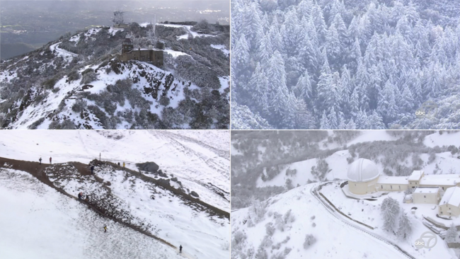
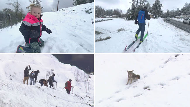
VIDEO: A look at the best snow videos from rare snowfall across Bay Area
Rainfall amounts will range from .25'-.75" with over an inch in the coastal hills.
Snow levels are expected to fall below 2,500 feet & the NWS may issue a local snow advisory (again).
The Sierra Nevada has a Blizzard Warning Monday through Wednesday with 5-7 feet of snow expected.

VIDEO: SKY7 flies over Bay Area snow-capped mountains, hills