Storm timeline: Here's when the heaviest rain and strongest winds will come Tuesday


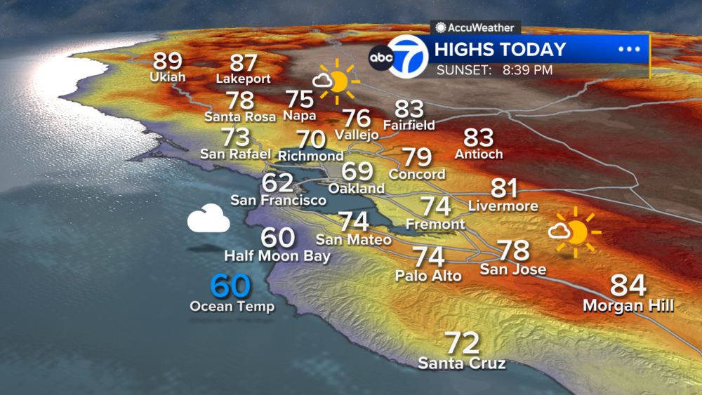
SAN FRANCISCO (KGO) -- Rain and wind return Tuesday with a level 2 storm on the ABC7 Exclusive Storm Impact Scale.

Meteorologist Drew Tuma says this system looks to move through pretty quickly which will limit impacts but we do anticipate more trees coming down as well as standing water on roads.

Expect light to moderate rain for the Tuesday AM commute. The worst time for heaviest rain and strongest winds will be between 9 am - 1 pm Tuesday.
RELATED: Officials urge Bay Area to stay vigilant ahead of next storm, not give into 'storm fatigue'
A Wind Advisory will be in effect for gusts 45-55 mph.


Heaviest rain exits in the early afternoon with showers becoming scattered for the rest of the day.
On our highest peaks (like Mt. Hamilton) we will see a dusting of snow.
In the Sierra, a Winter Storm Warning will be in effect for 2-4 feet of new snow.

California has been hit hard by storm after storm so far this year. The big question now - has the rain had any impact on the state's water levels? Go here for a closer look at where we stand with the drought, snowpack totals and reservoirs.
LIVE: Track real-time Bay Area weather conditions here
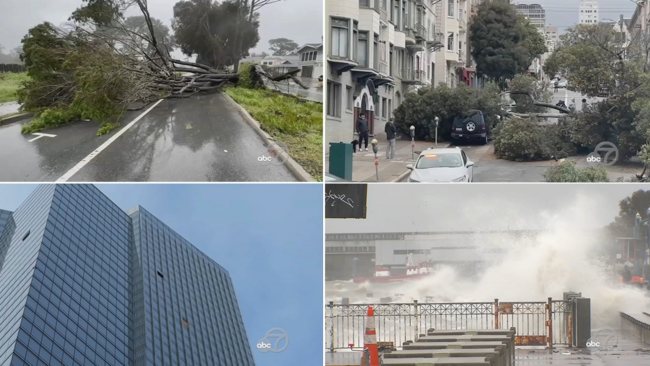
VIDEO: From a flying couch to crushed cars, videos show strength of deadly San Francisco Bay Area storm
Watch the latest AccuWeather forecast and take a look at recent weather stories and videos.