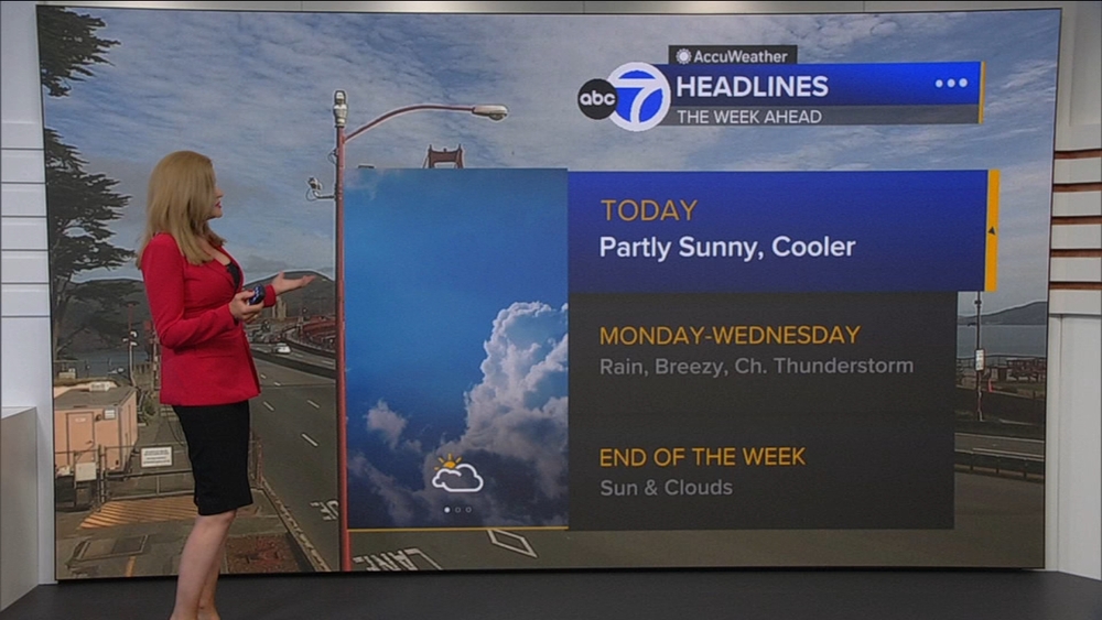
TIMELINE: 'Parade of storms' heading to Bay Area will bring heavy rain, possible flooding


SAN FRANCISCO (KGO) -- Multiple storms are bringing wet weather back to the Bay Area Friday evening, with the wet pattern continuing into early next week.
LIVE RADAR: Track storms as they move through the Bay Area with Live Doppler 7
Here's a timeline of this "parade of storms":
Friday
Friday is a Level 1 Light on the ABC7 Exclusive Storm Impact Scale.
Rain begins in the afternoon Friday and continues into Friday night.


Saturday - Monday
The storm coming Saturday through Monday will be a Level 2 Moderate.
There will be additional rainfall that is at times heavy.
Sunday evening through Monday will have the greatest potential for flooding, and flooding on our smaller streams and creeks may occur as a result of the rain. Roads will likely see nuisance flooding.
For the 49ers game Saturday, we do expect scattered showers and a kickoff temp in the upper 50s.
In the Sierra, snow levels will be high, above 6,000 ft. there will likely be 1-2 ft of new snow on the highest peaks.

Tuesday
Lighter showers are expected Tuesday.

Watch the latest AccuWeather forecast and take a look at recent weather stories and videos.

If you're on the ABC7 News app, click here to watch live"