Storm timeline: Cold front Monday brings rain, winds and snow with more expected Tuesday


SAN FRANCISCO (KGO) -- A strong but narrow cold front is on the way Monday morning. This Level 1 system will bring moderate to heavy rain, gusty winds & a wintry mix this morning.
It starts in the North Bay at 7 a.m. pushing south & east. At 11 a.m., heavy rain will push through the East Bay, Peninsula and the South Bay with 40-50 mph wind gusts at times.


This is the main event but scattered showers will continue throughout the day.
A third of an inch to .75" of rain is expected through today. Thunderstorms are possible as well.


LIVE: Track rain in San Francisco Bay Area with Live Doppler 7
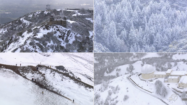
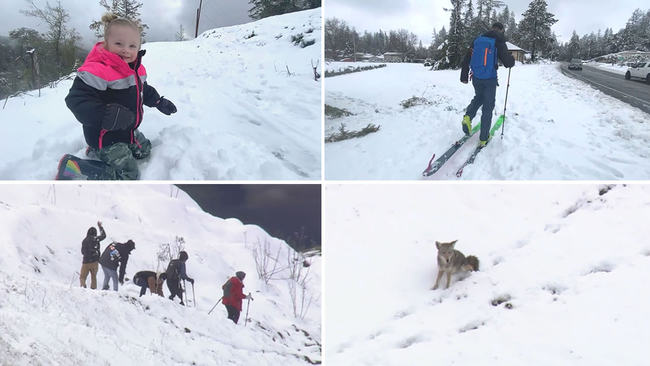
VIDEO: A look at the best snow videos from rare snowfall across Bay Area
The snow level will lower to around 2,500 feet. Snow is likely on our local hills but not like Friday with a Snow Advisory posted above 3000 feet.

Still, round two tomorrow brings more of the same with snow levels lowering a bit more & rainfall accumulation tipping one inch in some neighborhoods.
VIDEO: SKY7 flies over Bay Area snow-capped mountains, hills