Storm timeline: Another atmospheric river brings heavy rain, powerful winds to Bay Area
A High Wind Warning and Flood Watch go into effect Monday evening


SAN FRANCISCO (KGO) -- The Bay Area is set to get hit by another atmospheric river, with the highest impacts occurring between 2 a.m. - 9 a.m. Tuesday morning.
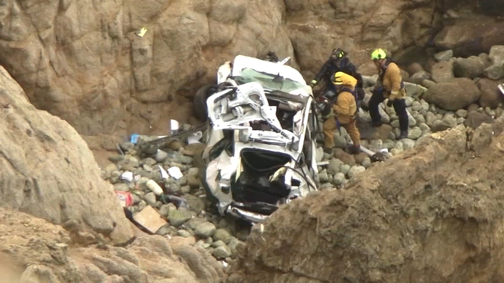
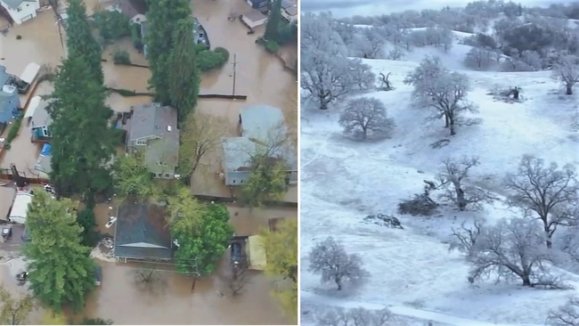
Flooding on roads and streams will happen faster than last Fridays atmospheric river because the ground is saturated and runoff will begin almost immediately. Wet soils will make it easier for trees to come down too.
LIVE: Track rain in San Francisco Bay Area with Live Doppler 7

Here is a look at the impacts of the storm.
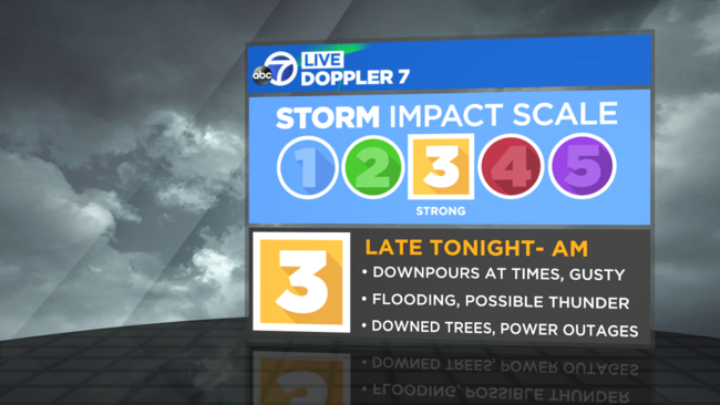
RAINFALL IMPACTS
Light rain begins after 8 p.m. Monday night. Rain will become heavy Tuesday morning.
The Tuesday morning commute will be a MESS. After 9 a.m., showers become scattered but downpours are still possible through Tuesday evening.
Rainfall totals will range from 1"-3" with higher amounts in the Santa Cruz Mountains.
We will see new flooding on area roads and also on streams/creeks. River flooding will continue to be exacerbated in Monterey County.
Higher than normal threat for mudslides with our ground already soaked. A Flood Watch is in effect.


WIND
Winds will be stronger with this atmospheric than our last one on Friday. Trees come down easier when the ground is already saturated. We are expecting numerous trees to come down along with scattered power outages. Wind will peak Tuesday morning with gusts up to 50mph in the Valley with the Coast possibly seeing gusts up to 70mph. A High Wind Warning is in effect.


SIERRA SNOW
This is another warm atmospheric river with snow levels above 6,500ft. One to 3 feet of snow is likely. Above 8,000 ft., we could see up to 5 feet. A Winter Storm Warning is in effect until Wednesday evening.

Take a look at the graph below to check out the latest Lake Tahoe snowpack totals. The snow total refers to the entire amount of snow that's currently at each site. The median is based on the last 30 years of data for March 9 (except for Carson Pass, which only has 16 years of historical data).
VIDEO: Is 2023 Bay Area's worst storm season? Here's what experts say
Click here to download the ABC7 News App to get your weather forecast on the go. And make sure you enable push alerts for immediate notifications and severe weather alerts. Click here for weather where you live.